Gujarat Map - Summary
The Gujarat Map is a crucial tool for anyone wanting to explore this lively state in India. Established on May 1, 1960, Gujarat was formed from the northern districts of the old Bombay state based on language (Marathi-speaking). While Gujarat is known for its industrial growth, it may not be the first tourist destination that comes to mind for many foreigners. However, it holds great importance within India and is home to a thriving business community.
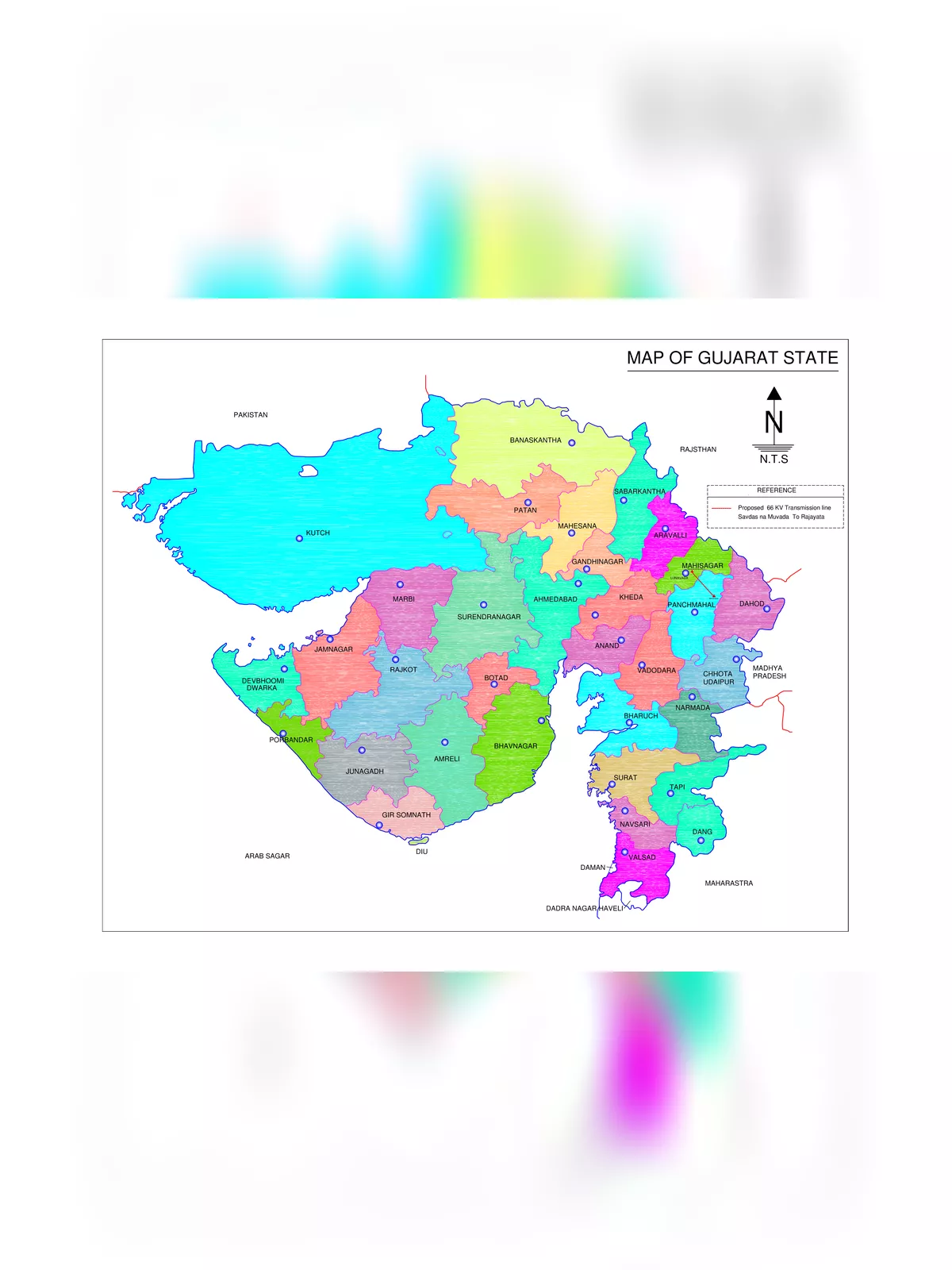
Discovering Gujarat
Gujarat is made up of 33 districts, including Ahmedabad, Amreli, Anand, Aravalli, Botad, Banaskantha, Bharuch, Bhavnagar, Chhota Udaipur, Dahod, Dang, Devbhoomi Dwarka, Gandhinagar, Gir Somnath, Jamnagar, Junagadh, Kheda, Kutch, Mehsana, Mahisagar, Morbi, Narmada, Navsari, Panchmahal, Patan, Porbandar, Rajkot, Sabarkantha, Surat, Surendranagar, Tapi, Vadodara, and Valsad.
Getting to Know the Gujarat Map
Gandhinagar is the capital city of the state, while Ahmedabad is its largest city. According to the 2011 census, Gujarat is home to 60,439,692 people, ranking it as the 9th most populated state in India. Covering an area of 1,96,024 square kilometers, it stands as the 5th largest state in India by area. The literacy rate here is 70.031 percent, with Gujarati being the primary language spoken. Gujarat is well-known for its sacred temples, including the Dwarkadheesh Temple and the Somnath Temple. It also boasts beautiful wildlife sanctuaries, stunning beaches, refreshing hill resorts, and vibrant, unique handicrafts.
Must-Visit Places in Gujarat
- Laxmi Vilas Palace – Baroda
- Somnath Temple – Near Veraval
- Dwarakadheesh Temple of Lord Krishna – Dwarka
- Haji Pir Dargah – Kutch
- Gir Forest National Park – Junagadh
- Lothal – near Ahmedabad
- Dholavira – Kutch
- Saputara Hill Station – Dang district
- Kirti Mandir – Porbandar
You can download the Gujarat Map PDF using the link provided below.