South America Political Map - Summary
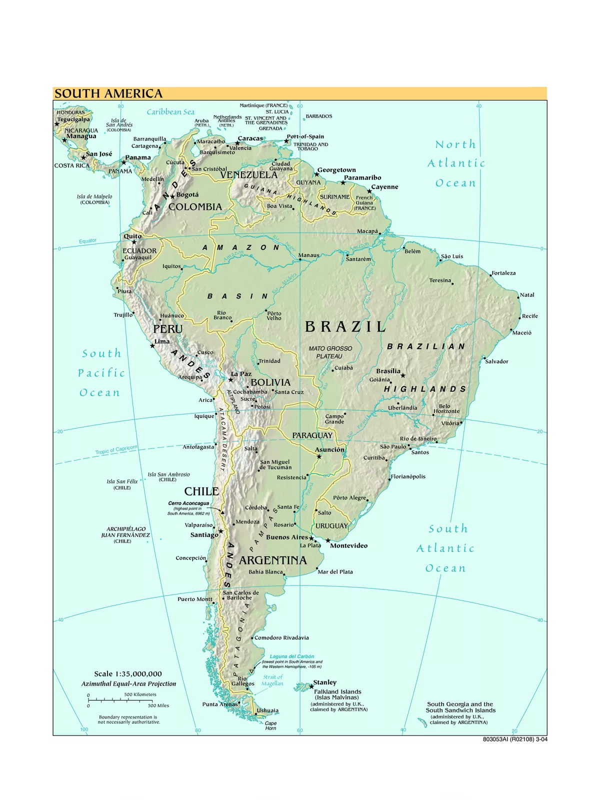
South America is a vibrant continent of extremes, featuring incredible geographical wonders like the Amazon, the world’s largest river, and the Atacama Desert, the planet’s driest place. As the fourth-largest continent, South America stretches from the Gulf of Darién in the northwest to the archipelago of Tierra del Fuego in the south.
South America Political Map PDF is essential for anyone wanting to explore this beautiful continent. The continent consists of twelve sovereign states: Argentina, Bolivia, Brazil, Colombia, Chile, Ecuador, Guyana, Peru, Paraguay, Suriname, Uruguay, and Venezuela. Additionally, it includes two dependent territories: the Falkland Islands and South Sandwich Islands, along with one internal territory known as French Guiana.
Explore the South America Political Map
- South America comprises the southern half of the combined landmass known as the Americas.
- It connects to North America through the Isthmus of Panama.
- This continent is mainly located in the Southern Hemisphere, bordered in the west by the Humboldt Current of the Pacific Ocean, in the east by the Brazil Current of the Atlantic Ocean, and in the north by the Caribbean Sea.
- As the fourth-largest continent on Earth, it is home to twelve sovereign states: Argentina, Bolivia, Brazil, Chile, Colombia, Ecuador, Guyana, Paraguay, Peru, Suriname, Uruguay, and Venezuela.
You can easily download the South America Political Map PDF using the link provided below.