Physical Map India - Summary
Physical maps are essential tools that depict the natural landscape features of our planet. These maps are particularly valuable for illustrating topography, often using a blend of colors or shaded relief techniques. Typically, physical maps utilize a green, brown, and gray color scheme to represent various elevations of the land.
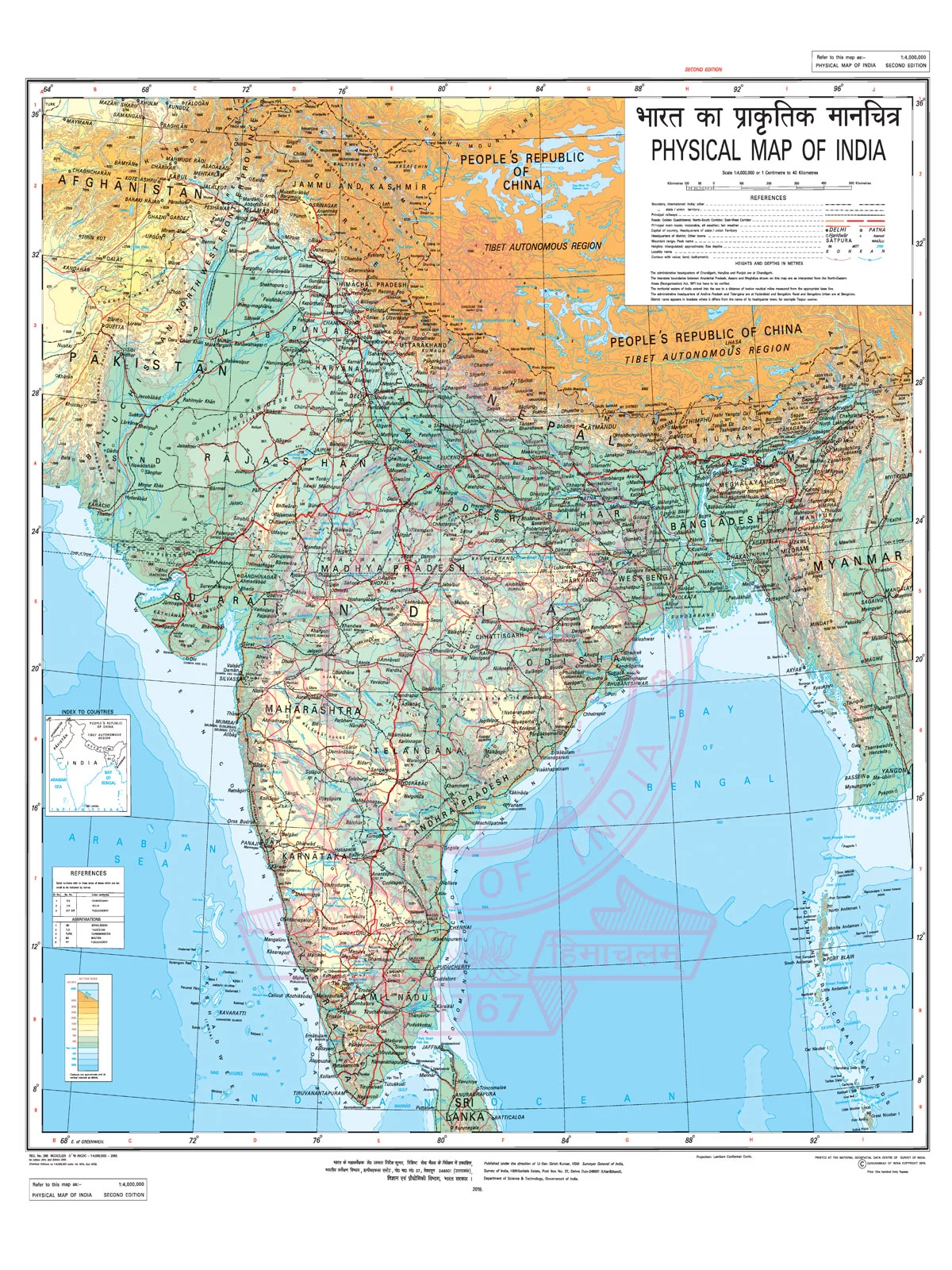
A physical map of India serves as a handy resource for students, educators, and parents alike. They can easily download this map as a PDF for offline use, making it perfect for educational purposes. By referring to the Indian physical map, users can improve their understanding of India’s diverse physical features. It allows for easy identification of crucial areas or physiographic regions within the country:
- The Himalayan Mountain Range (the highest range of mountains in the globe)
- The Indian Peninsula
- The Indo-Gangetic Plains
- The Great Indian Thar Desert
- The Western and Eastern Ghat Mountain Ranges
- The Karakoram Mountain Range
Features of the India Physical Map
A physical map of India effectively illustrates all the physiographic regions of the nation. Based on physiography, these regions can be categorized as follows:
- The Islands
- Coastal Plains
- The Peninsular Plateau
- The Great Indian Desert
- Northern Plains or Indo-Gangetic Plains
- The Himalayan Mountain Ranges or Northern Mountains
Rivers and Streams in the Map
This map also emphasizes the significant rivers and streams of India, such as the Yamuna, Ganga, Sutlej, Jhelum, Indus, and Godavari. The user-friendly design of the map includes a scale for measuring the elevation of various regions throughout the country.
You can download the India Physical Map PDF using the link given below.