World Physical Map 2025 Overview and Features - Summary
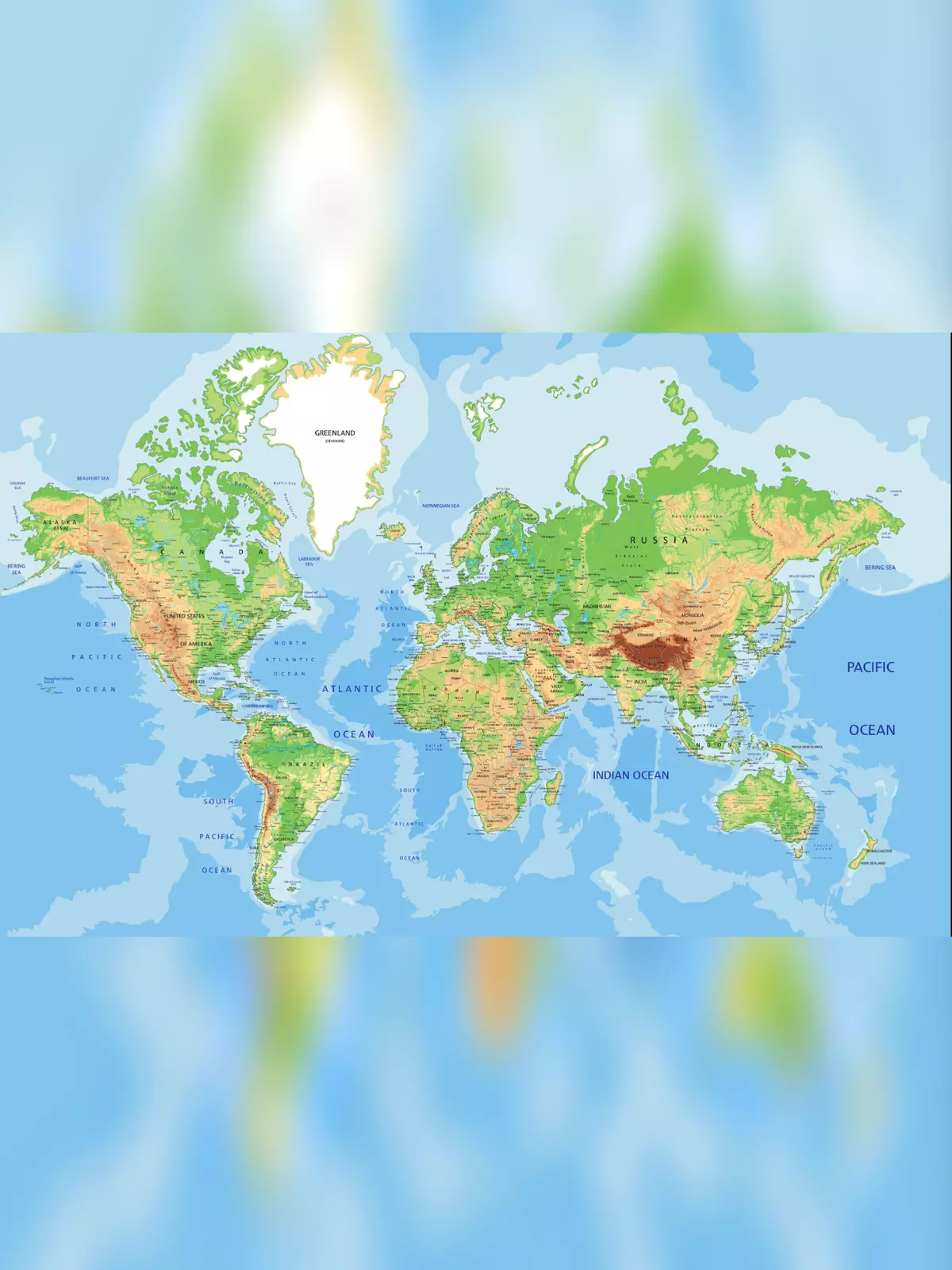
A world physical map is a useful tool that shows Earth's natural features like mountains, rivers, oceans, and deserts in a clear and simple way. This map highlights important geographical parts such as continents, oceans, large islands, deserts, mountain ranges, countries, and capital cities. It gives a clear look at the Western Hemisphere's surface, with South America in the center and Antarctica at the bottom.
Find Out About the World Physical Map PDF Download
If you want a detailed and handy reference for Earth's physical geography, you can download the world physical map PDF available on our site. This map is great for students, teachers, and geography lovers who want an updated and clear map for study or presentations.
Main Features Shown on the World Physical Map
- Earth's surface, measured at sea level, covers just over 510 million km². Water bodies make up about 71% of this area, which is around 360 million km².
- Land covers about 29% of the surface, including all the rocks, mountains, deserts, rivers, lakes, and farmland, adding up to about 150 million km² with Antarctica included.
- The highest point on Earth shown is Mount Everest (Chomolungma), reaching 8,848 m (29,029 ft) tall. It is part of the Himalayan Mountains located on the border between Nepal and China.
- Lake Titicaca, the highest lake you can navigate, sits at an elevation of 3,812 m in the Andes and is the biggest lake in South America, shared by Bolivia and Peru.
- The Pacific Ocean, the largest ocean, covers about 165 million km², lying between the Americas to the east and Asia and Australasia to the west.
- The Atlantic Ocean is the second largest, covering nearly 80 million km², located between the Americas on the west and Europe and Africa on the east.
- The Indian Ocean, the third-largest, covers around 70.5 million km².
The world physical map PDF download for 2025 gives updated information to help you understand Earth's surface in a simple and interesting way. Make sure to download the latest version for the most accurate and easy-to-read physical map.