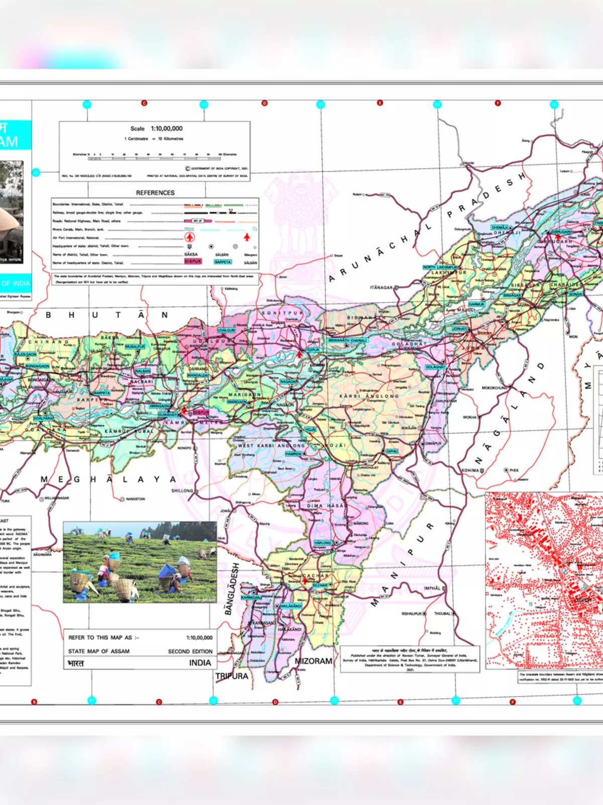
Assam Map 2025 - Summary
An Assam Map is very helpful for getting to know this large and fascinating state in Northeast India. Assam is located below the eastern Himalayas, along the well-known Brahmaputra and Barak River valleys. It shares its borders with states like Nagaland and Manipur to the east, Meghalaya, Tripura, Mizoram, and even the country Bangladesh to the south, and West Bengal to the west. Looking at an Assam map helps you see exactly where it is in India.
Discovering Assam with a Detailed Map PDF (2025)
Assam is famous for growing many crops like rice, maize (corn), pulses, potatoes, and wheat. It’s especially known for cash crops like tea, jute, oilseeds, sugarcane, cotton, and tobacco. The northern part of Assam mainly includes the long valley of the River Brahmaputra. This is also where most people in Assam live. When the Brahmaputra river enters Assam, it becomes very wide, spreading out over 16 km with many smaller rivers joining it. This creates a large flood plain. People often call this river the ‘Life-line of Assam’ because it is so important to the state.
Main Details and Fun Facts from the Assam Map PDF 2025 Download
If you download an Assam Map PDF, you can find out many interesting things about the state. Here are some quick facts:
| Capital | Dispur |
| Date of Formation | 1912 (Assam Province – British India), 15 August 1947 |
| Governor | Gulab Chand Kataria |
| Chief Minister | Himanta Biswa Sarma |
| Tourist Attractions | Kamakhya temple, Umananda (Peacock Island), Navagraha (temple of nine planets), Basistha Ashram, Dolgobinda, Kaziranga National Park, Pobitora Wildlife Sanctuary |
| Festivals | Bihu, Sivaratri Mela, Baishagu, Majuli Festival, Ambubachi Mela |
| Major Dance and Music Forms | Bihu dance, Sattriya dance |
| Arts and Crafts | Jappi (traditional hat), toys made of clay, cork, wood and bamboo. Satras or monasteries keep art and culture alive, Silk products (Muga, Eri, Pat) |
| Languages | Assamese, Bodo, Karbi, Bengali, Mishing, Tiwa |
| Size | 78,438 km2 (30,285 sq mi) |
| Population (Census 2011) | 31,169,272 |
| Rivers | Brahmaputra, Manas, Subansiri, Sonai, Barak River, Dhansiri River |
| Forests and Wildlife Sanctuaries | Kaziranga NP, Manas NP, Orang Sanctuary, Nameri National Park, Dibru-Saikhowa National Park |
| State Animal | One-horned rhinoceros |
| State Bird | White-winged wood duck |
| State Flower | Foxtail Orchid (Rhynchostylis retusa) |
| State Tree | Hollong (Dipterocarpus retusus) |
| Major Crops | Rice, jute, tea, Mustard, Sugarcane |
| Interesting Fact | Tezpur was known as the ‘city of blood’ after a mythical battle between Lord Shiva and Lord Vishnu. Assam is also home to the world’s largest river island, Majuli. |
| Number of Districts: As of 2025, Assam has 35 districts. | 35 |
Knowing these facts and having an Assam Map 2025 can help you learn a lot about this beautiful state.