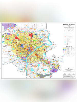
Kushal Nagara City Master Plan 2031 - Summary
Kushalnagar City Master Plan 2031 is the official land-use zoning map issued by Kushalnagar Planning Authority under the Directorate of Town and Country Planning, Government of Karnataka. Approved under Section 13(3) of the Karnataka Town and Country Planning Act, 1961 vide Government Order No. NAHAE 171 MYAHPRA 2022, this plan directs urban development and zoning allocations across the local planning area up to 2031.
This single-page official PDF contains the full proposed land-use map at 1:6000 scale (Drawing No. 17). It covers a total planning area of 1,105.00 hectares in Kodagu district, detailing 933.96 hectares of planned urban development alongside designated agricultural zones, water bodies, and environmental buffer belts.
Land use zoning in Kushalnagar planning area
The master plan establishes precise land-use allocations for urban expansion and environmental protection:
- Residential zone covers 454.28 hectares, forming 48.64 percent of the developed area.
- Commercial zone spans 68.26 hectares (7.31 percent) to support local business centres.
- Industrial zone allocates 96.84 hectares (10.37 percent) for industrial activities.
- Parks, open spaces, and public utilities cover 134.37 hectares for civic infrastructure.
- Traffic and transportation networks occupy 127.15 hectares (13.61 percent) for road widening and transit corridors.
- Agricultural preservation land accounts for 150.34 hectares outside the urban boundary.
Planning regulations and official access
Property owners, builders, and layout developers must follow the zoning regulations specified in this master plan before applying for building permissions, land conversion, or layout approvals. Similar urban frameworks in Karnataka include the Magadi City Master Plan 2031 and the Nelamangala City Master Plan 2031.
For official notifications, zonal regulations, and planning scrutiny services, visit the Kushalnagara Planning Authority Master Plan Portal.