Samruddhi Mahamarg Route Map - Summary
Samruddhi Mahamarg will be opened and inaugurated by Prime Minister Narendra Modi on December 11, 2022. The first phase (502 km) will connect Nagpur – Shirdi. Samruddhi Mahamarg (Nagpur Expressway) by MSRDC is an under-construction 6-lane access-controlled road with a route alignment connecting Village Shivmadka in Nagpur District to Village Amne in Thane District.
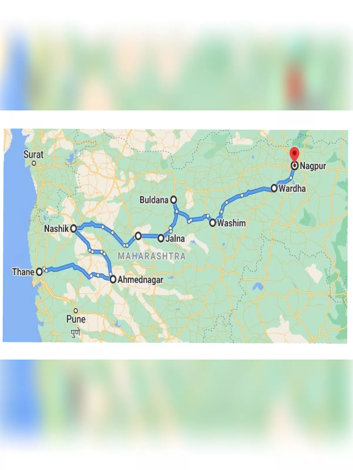
Samruddhi Mahamargexpressway connects the districts of Nagpur, Wardha, Amravati, Washim, Buldhana, Aurangabad, Jalna, Ahmednagar, Nashik, and Thane. Its route passes through 3 wildlife sanctuaries. To protect wildlife, several overpasses, underpasses, and high culverts will be built. The expressway features a 310m bridge over river Wardha, 33 major bridges, 274 minor bridges, 65 viaducts/flyovers, and six tunnels through the Western Ghats. The longest tunnel is being built at Kasara Ghat, Igatpuri.
Samruddhi Mahamarg Route Map – Information
| Name of the expressway | Samruddhi Mahamarg |
| Total Estimated Cost | Rs. 55,000 crore |
| Project Length | 701 km |
| Lanes | 6 |
| Status | Under Construction |
| Opening | 2022 (502 km Nagpur – Shirdi) |
| Deadline | 2022-end |
| Land Acquisition Required | 24,255 acres (9,900 Ha) |
| Official Name | Hindu Hrudaysamrat Balasaheb Thackeray Maharashtra Samruddhi Mahamarg |
| Also Known As | Nagpur-Mumbai Super Communication Expressway |
| Owner | Maharashtra State Road Development Corporation (MSRDC) |
| Project Model | EPC (Engineering, Procurement and Construction) |
Samruddhi Mahamarg Expressway Route Map
An official PDF route map of the Mumbai – Nagpur Expressway will be added here when available. Samruddhi Mahamarg expressway will be connected to the following upcoming expressways:
- 141 km Nagpur – Bhandara – Gondia Expressway
- 152 km Nagpur – Gadchiroli Expressway
- 760 km Nagpur – Goa Expressway (Shaktipeeth Expressway)
- 225 km Pune – Aurangabad Expressway
- 180 km Pune – Nashik Expressway
You can download the Samruddhi Mahamarg Route Map PDF using the link given below.