Nadia District Map - Summary
The Nadia District Map is essential for anyone wanting to explore the beautiful and culturally rich Nadia district, located in the heart of the Bengal delta. This area is embraced by the Ganga, specifically the Bhagirathi on the west and Mathabhanga on the north. The entire district is part of the Ganga’s alluvial plain, along with its tributaries. Interestingly, while many districts in West Bengal are named after their headquarters, Nadia district is named for Nabadwip, deeply associated with the memory of Lord Shri Chaitanya Mahaprabhu, who was born here on 18th February 1486. The British formalized Nadia as a district in 1787, and the present-day district was established post-partition by Notification No. 545-GA dated 23rd February 1948.
Geography of Nadia District
The Nadia district is bordered to the north and northwest by Murshidabad, while it shares its southeast and eastern boundaries with the Republic of Bangladesh. To the south and southeast, the district is adjacent to the North 24-Parganas district. The geographical shape of Nadia is irregular, stretching from north to south. The elevation of the district is approximately 46 feet above mean sea level, and the Tropic of Cancer runs through the area, dividing it into two parts.
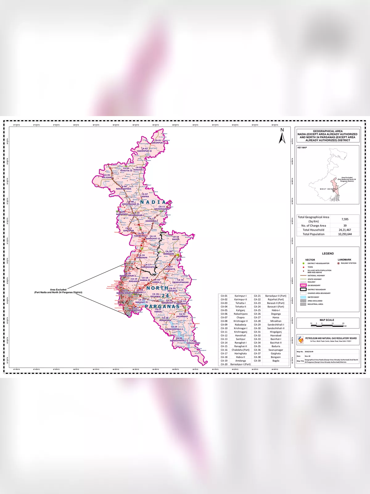
Nadia District Map
You can download the Nadia District Map PDF using the link given below.