Madhya Pradesh (MP) Map - Summary
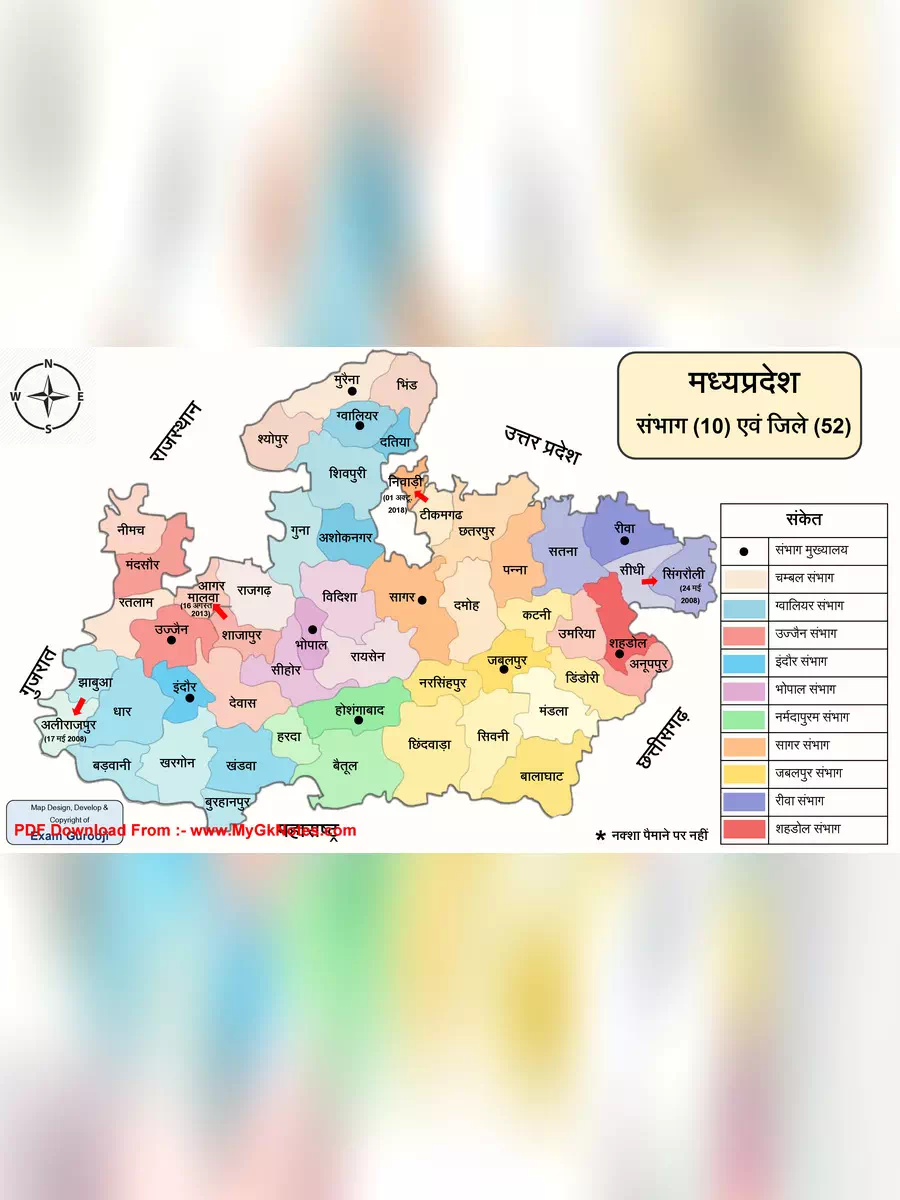
Madhya Pradesh, known as the “Heart of India,” is the second largest state in our country and is well-loved for its central location. This enchanting state is surrounded by Rajasthan, Chhattisgarh, Uttar Pradesh, Maharashtra, and Gujarat.
Bhopal is the proud capital of Madhya Pradesh, while Indore is celebrated as its largest city. Madhya Pradesh has a rich history, having been ruled by many powerful dynasties like the Mauryans, the Mughals, and the Marathas. By the early 18th century, the state was divided into several small kingdoms, which were later combined by the British into the Central Provinces and Berar, along with the Central India Agency.
As per the 2011 census, the population of Madhya Pradesh is 72,567,565, and it covers an impressive area of 308,252 square kilometers.
Download the Madhya Pradesh Map
You can easily download the Madhya Pradesh Map in PDF format using the link given below.
Explore More About Madhya Pradesh
Madhya Pradesh is not only rich in history but also teeming with culture and natural beauty. With stunning landscapes and historical sites around every corner, there is endless joy in discovering everything this state has to offer!
Don’t forget to visit the link to download your PDF of the Madhya Pradesh Map and get to know this remarkable state even better!
Madhya Pradesh (MP) Map Hindi PDF Download
RELATED PDF FILES-
 Voter List 2003 Madhya Pradesh – MP OLD SIR Voter List
-
 CEO Madhya Pradesh Voter List 2026
-
 Madhya Pradesh (MP) Liquor Price List 2026
-
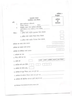
 Indira Gandhi Rashtriya Vridhavastha Pension Yojana Form Madhya Pradesh Hindi
-
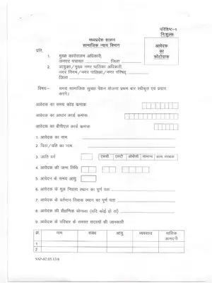
 Indira Gandhi National Widow Pension Scheme Application Form Madhya Pradesh Hindi
-
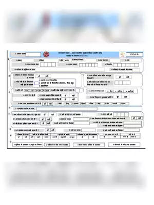 SSSM Survey Form Madhya Pradesh
-
 Madhya Pradesh Social Security Pension Scheme Application Form Hindi
-
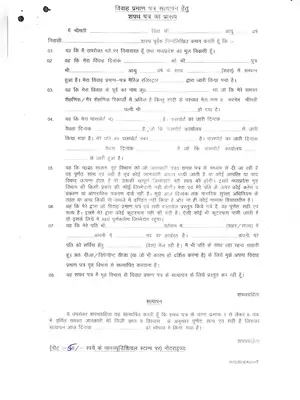 Madhya Pradesh Marriage certificate verification Form Hindi