World Maps - Summary
Looking for world maps in PDF format? This article helps you find and download high-resolution world maps in PDF. You can also get a political map of the world focusing on Europe and Africa. These maps show the locations and names of most countries around the world. Keep in mind, since the Earth is round, flat maps will always have some distortion.
In 2025, you can check out our large collection of high-quality, free world maps ready for download! Whether you are a student, traveler, teacher, or researcher, these maps offer important details about Earth’s landforms, countries, populations, and oceans. Experience the richness of our planet by downloading these easy-to-use PDF maps.
Details About Our World Map PDF Collection
Our high-resolution world maps are flat (two-dimensional) images showing continents, oceans, main countries, and a grid of latitude and longitude lines, called the geographic coordinate system. These maps are great for learning and quick reference.
Different Types of World Maps Available for Download
Here are different types of world maps in clear, high-resolution vector format that you can download depending on your needs:
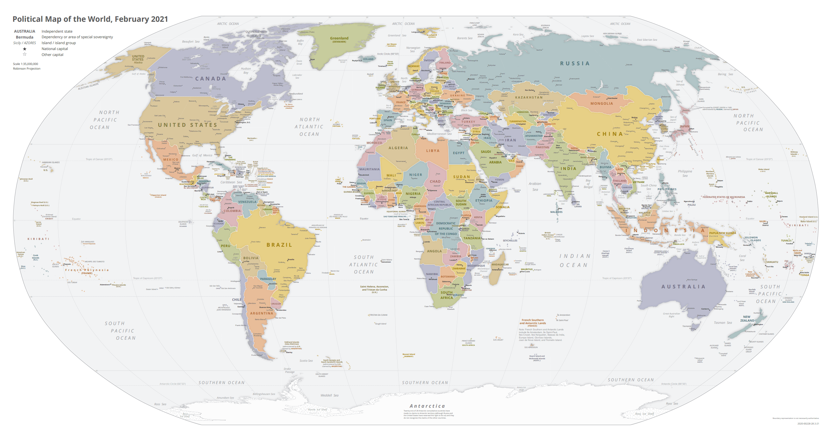
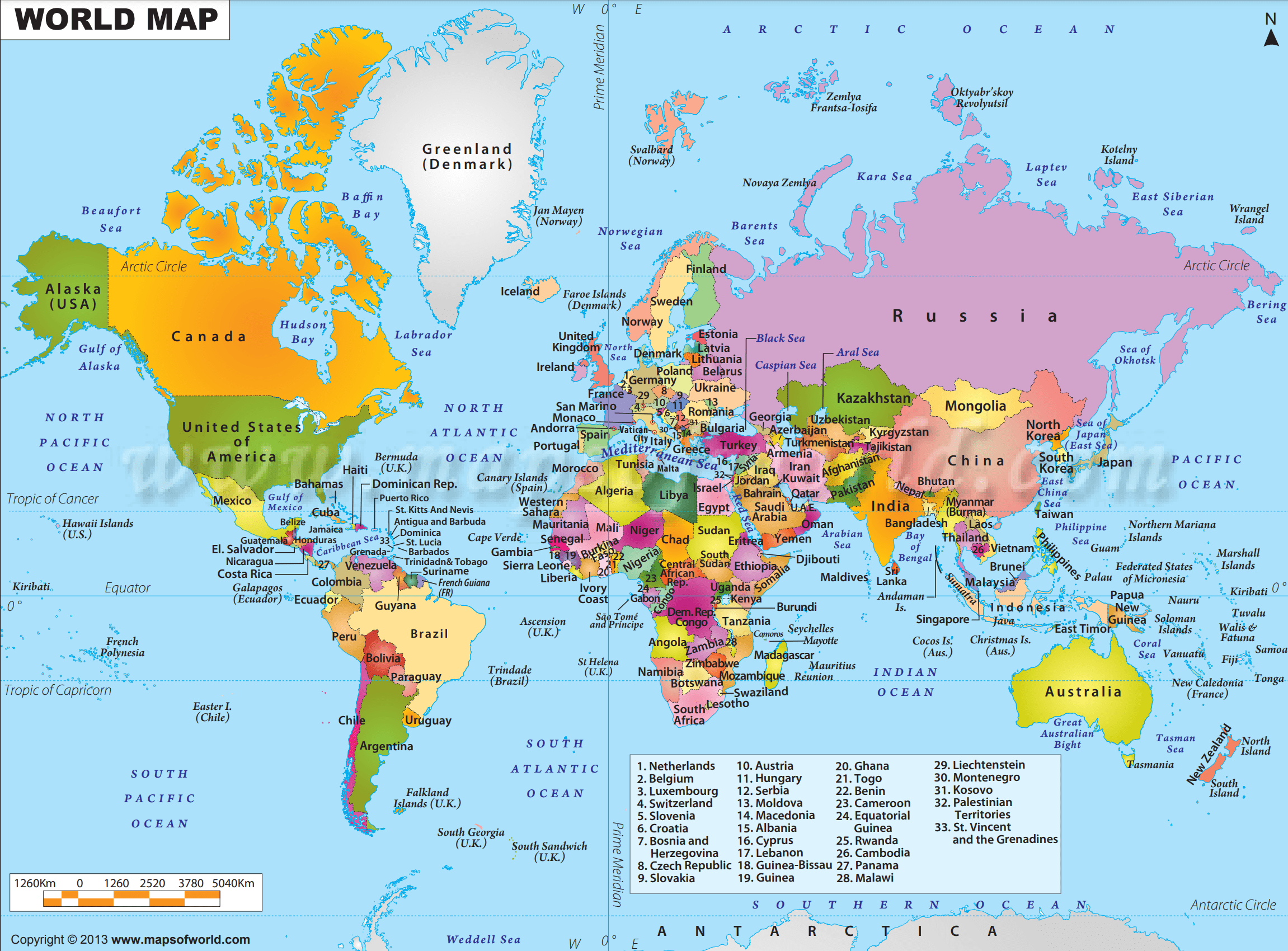
Political Map of the World, November 2021
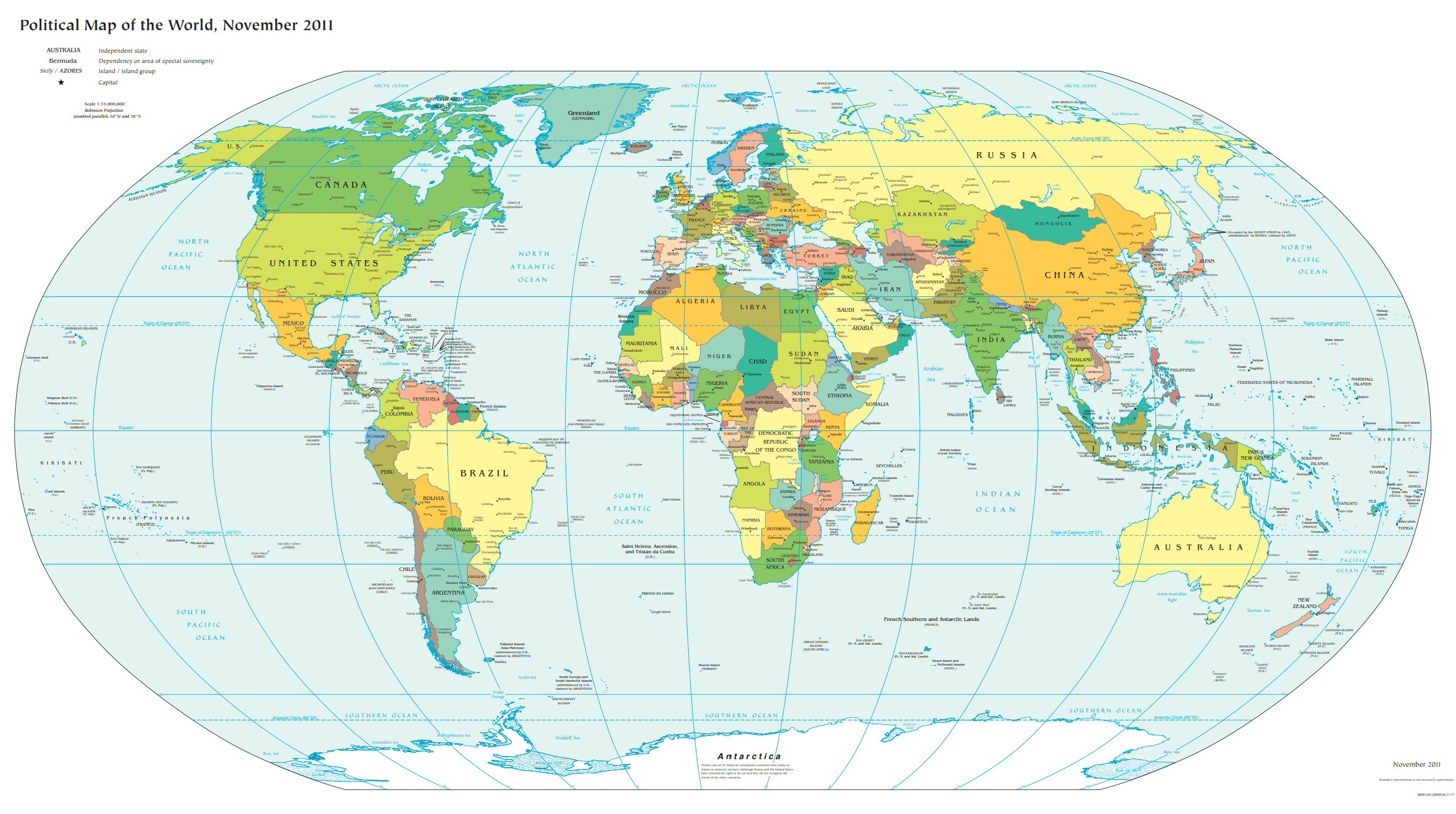
Political Map of the World, November 2011
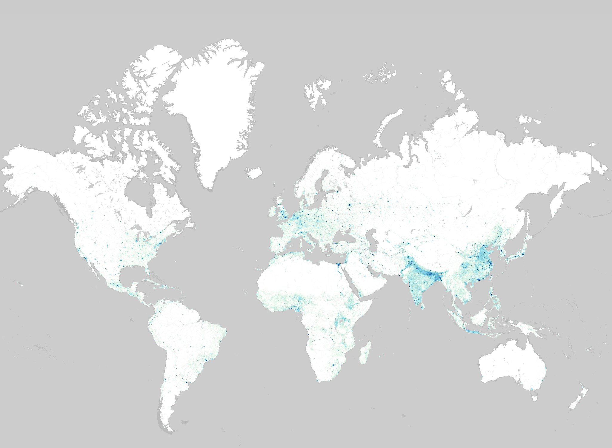
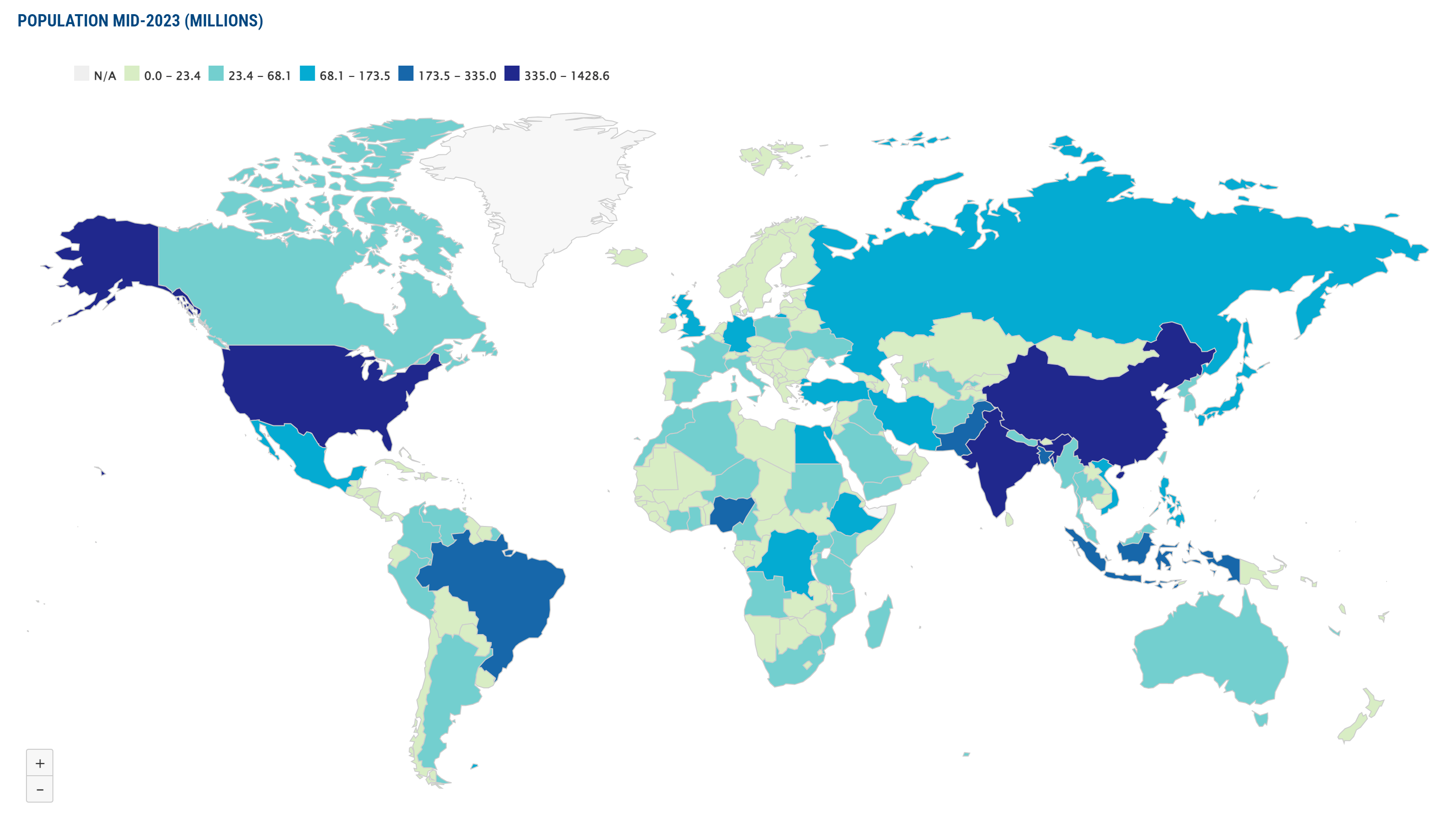
Population Maps of the World
Printable World Map with Countries Names
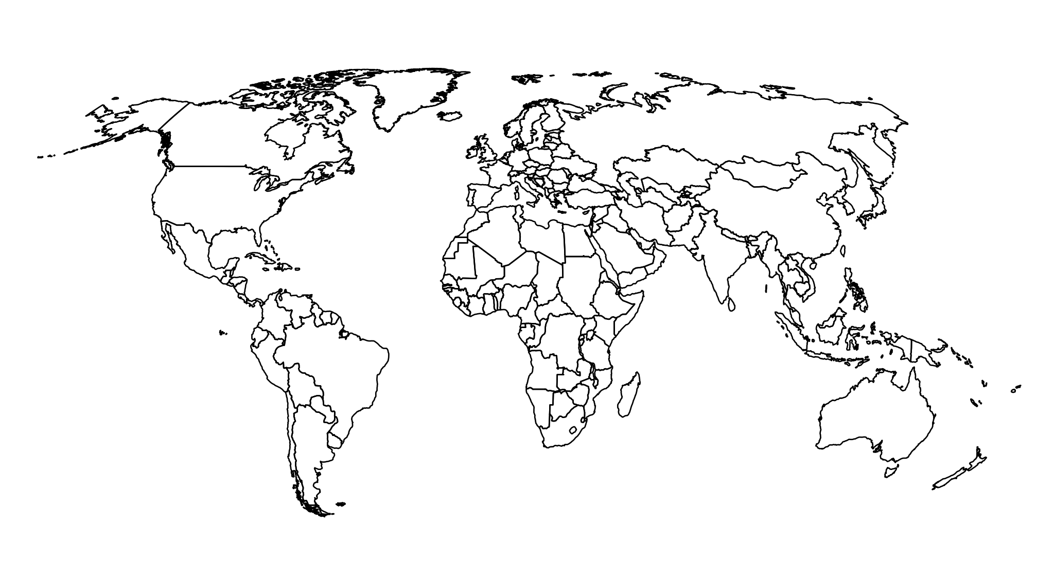
Blank Outline World Map for Various Uses
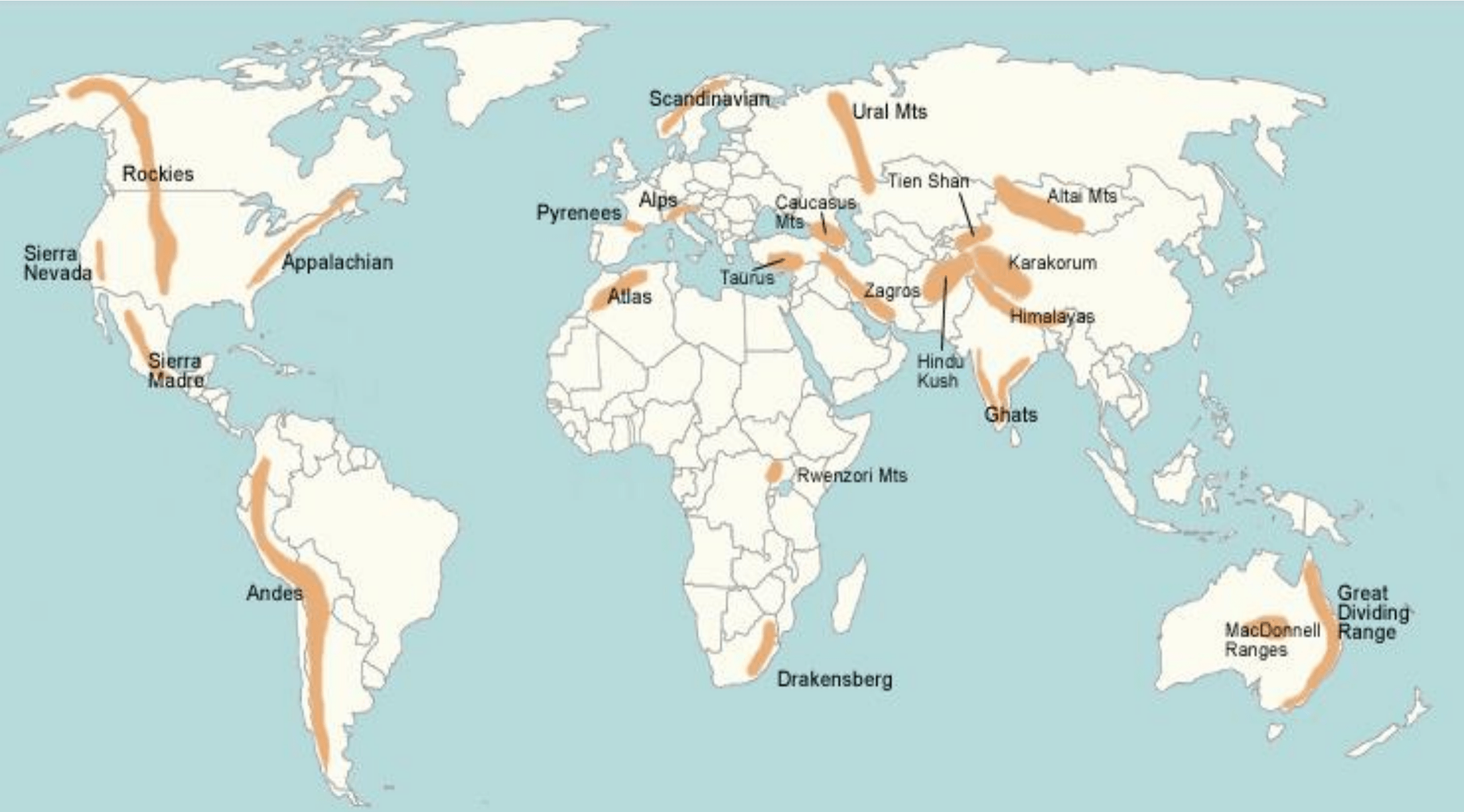
World Map Showing Major Mountain Ranges
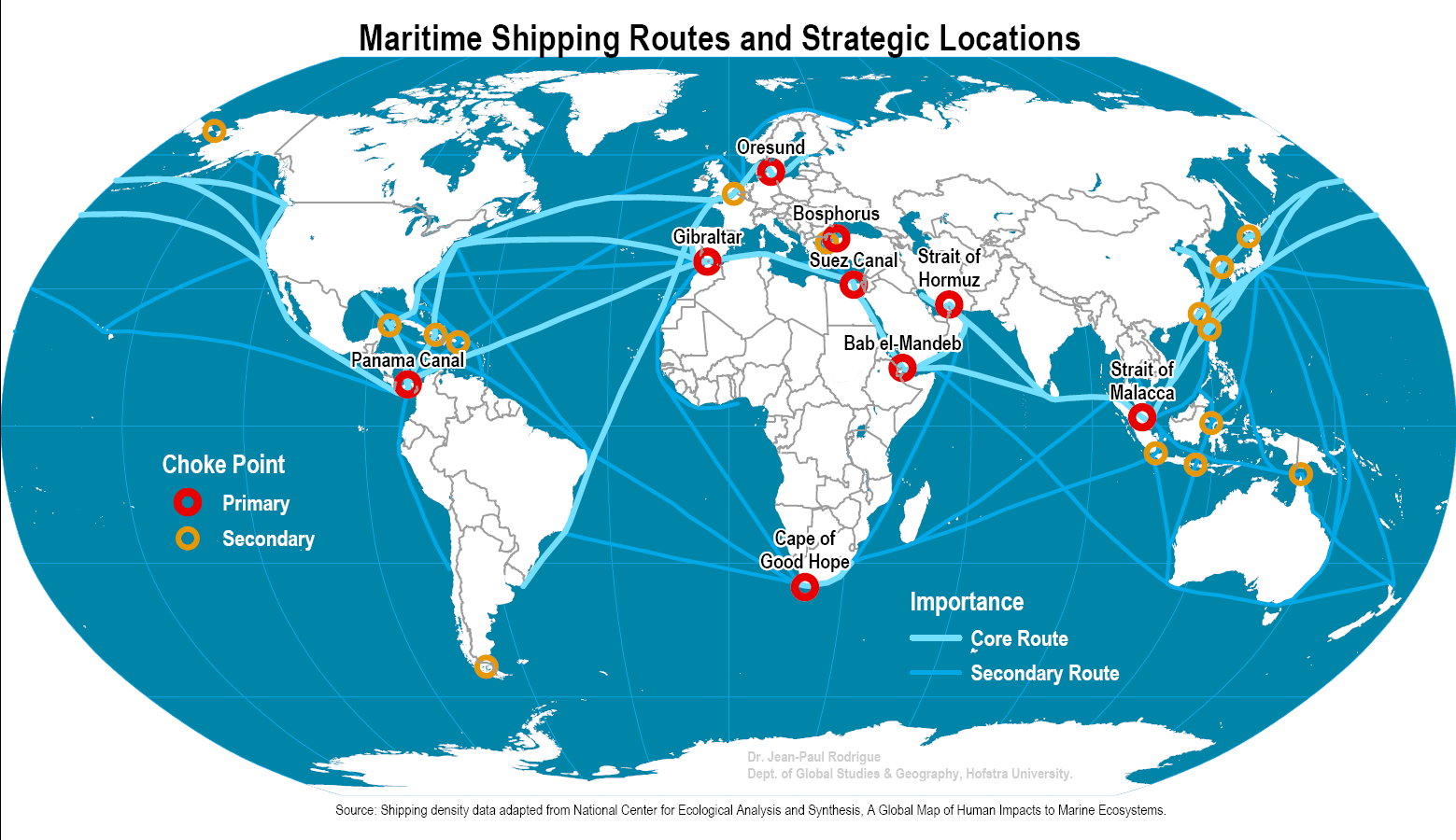
World Map with Major Maritime Shipping Routes
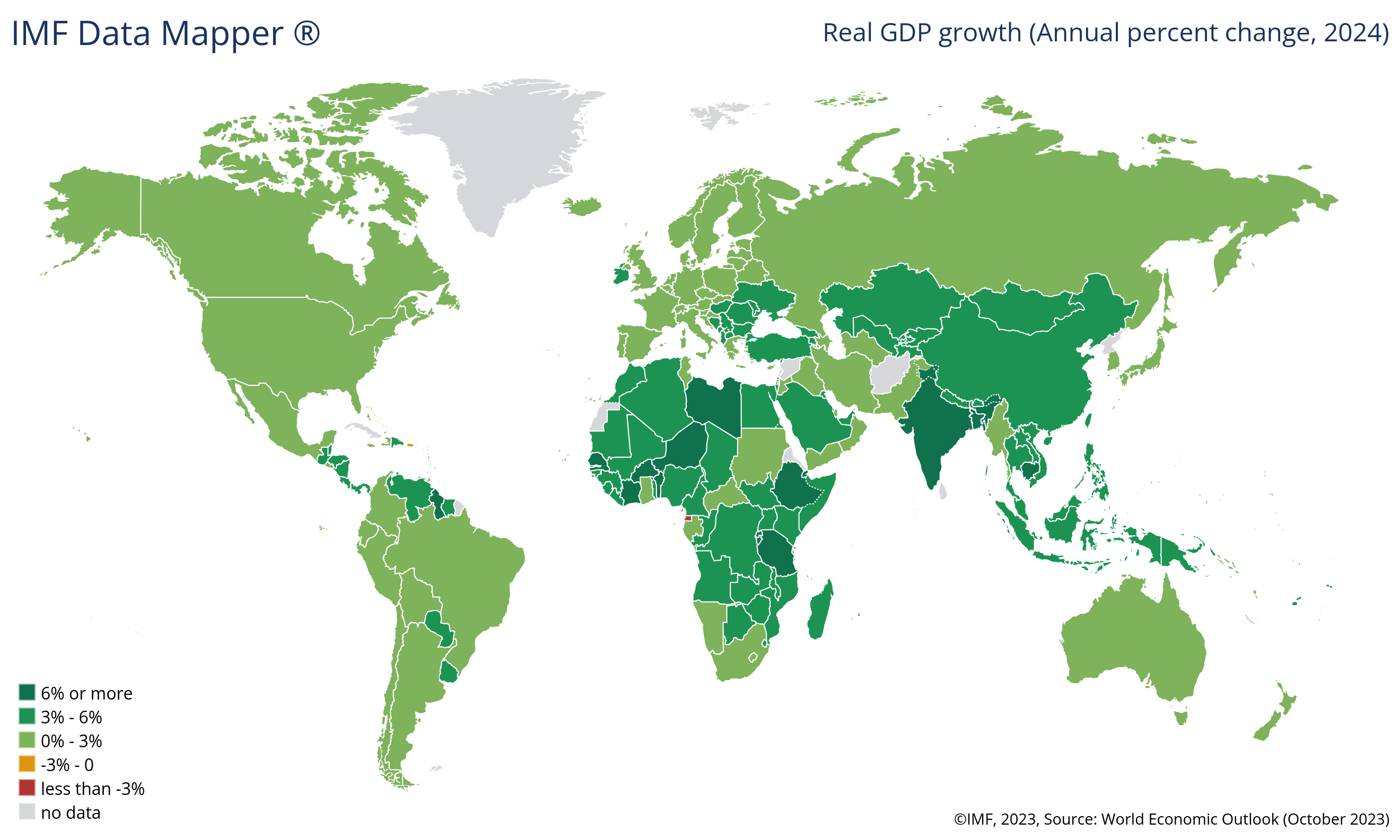
GDP Growth Rate Map
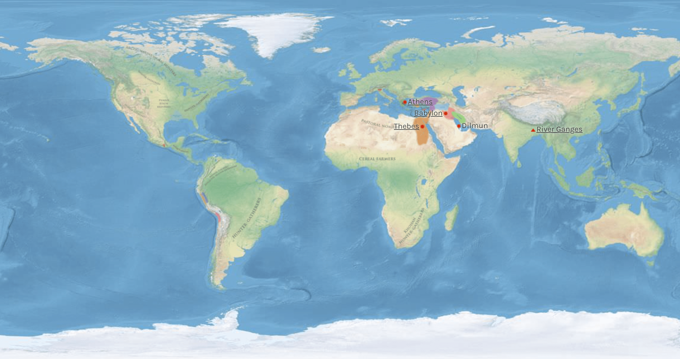
Map of the Ancient World
How Different World Maps Are Used
Population Maps
- Demographic Analysis: See how many people live in different parts of the world for studies, planning, and making rules.
- Cultural Studies: Learn about how different groups of people live by seeing where they are found.
Physical Maps
- Geography Learning: Find natural features on Earth like mountains, rivers, and oceans.
- Environmental Research: Study the land, weather, and living things to help protect nature and understand climate change better.
Mountain Range Maps
- Adventure Planning: Use these maps to plan your hiking and climbing trips by spotting important mountains.
- Geology Exploration: Learn how mountains were formed and how the Earth’s surface changes over time.
Blank Maps
- Learning Tool: Teachers and students can use these blank maps to draw on and learn about places.
- Creative Purposes: Use blank maps for fun activities, games, or creating maps as art.
Printable Maps
- Classroom Resources: Easily print maps for school or homework.
- Travel Use: Print maps to take on trips so you don’t get lost.
Historical Maps
- History Research: See how countries and kingdoms changed over time by looking at old maps.
- Family History: Find out where your family came from by using maps that show past places and regions.
Political Maps
- Geopolitical Studies: Understand where countries are and how they relate to each other.
- Citizen Awareness: Stay informed about elections and how governments work around the world.
Climate Maps
- Weather Prediction: Study weather patterns, like rain and heat, to help predict what the weather will be like.
- Ecological Insights: Use weather info to understand how climate affects plants and animals, especially with climate change.
Time Zone Maps
- Travel Scheduling: Plan your trips and calls across the world without getting confused by time differences.
- Global Connections: Stay connected with people in different parts of the world by knowing their local time.
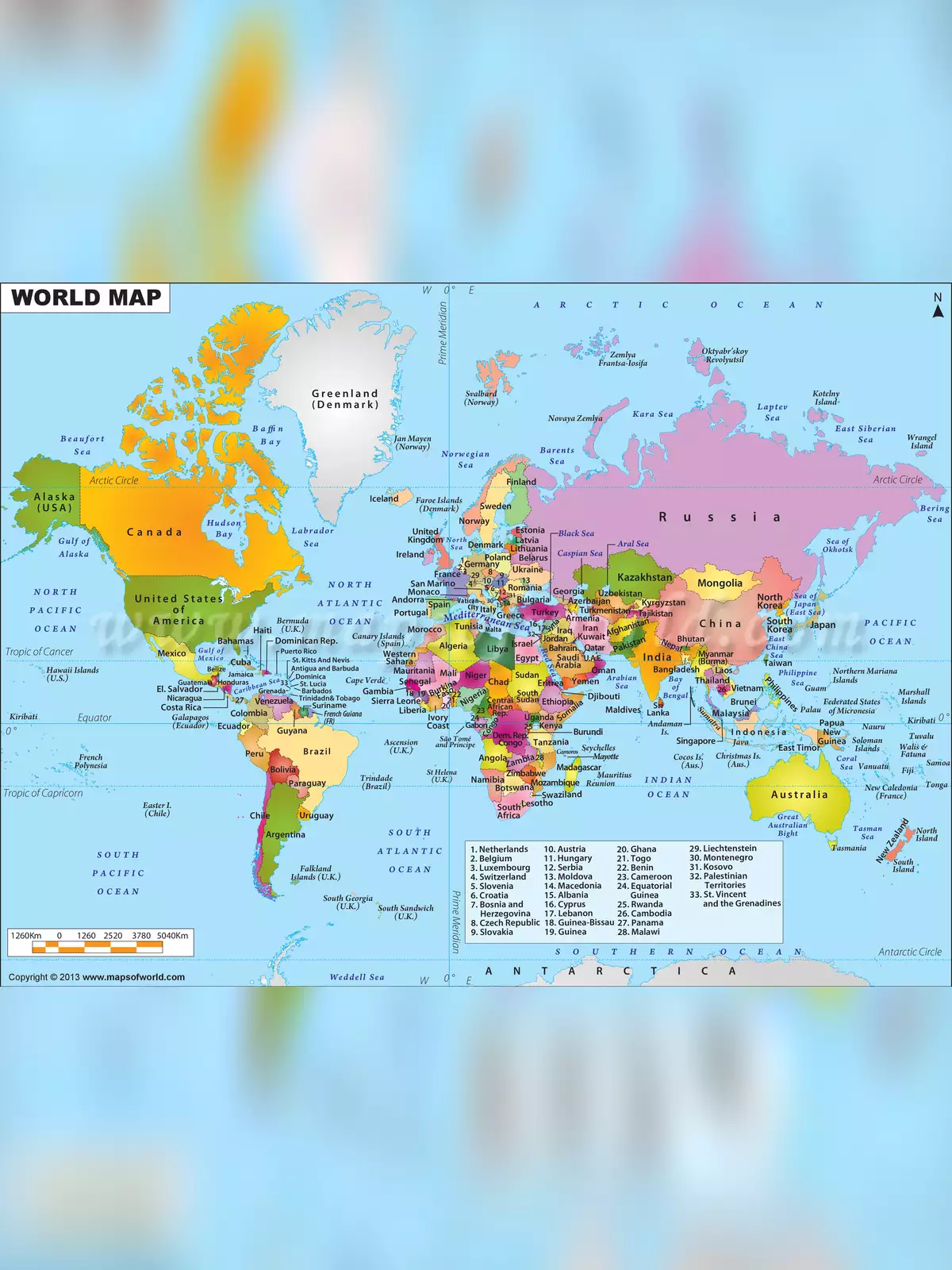
World Map with Countries List
This map shows the main parts of the world, the lines that divide countries, and the latitude-longitude lines. Asia is the biggest continent with the most people. It covers 30% of the Earth’s land and has 60% of the world’s population, including big countries like India. Africa is the second largest, with 20% of the land and 15% of the people.
- A
- Afghanistan
- Albania
- Algeria
- Andorra
- Angola
- Antigua and Barbuda
- Argentina
- Armenia
- Australia
- Austria
- Azerbaijan
- B
- The Bahamas
- Bahrain
- Bangladesh
- Barbados
- Belarus
- Belgium
- Belize
- Benin
- Bhutan
- Bolivia
- Bosnia and Herzegovina
- Botswana
- Brazil
- Brunei
- Bulgaria
- Burkina Faso
- Burundi
- C
- Cabo Verde
- Cambodia
- Cameroon
- Canada
- Central African Republic
- Chad
- Chile
- China
- Colombia
- Comoros
- Congo, Democratic Republic of the
- Congo, Republic of the
- Costa Rica
- Côte d’Ivoire
- Croatia
- Cuba
- Cyprus
- Czech Republic
- D
- Denmark
- Djibouti
- Dominica
- Dominican Republic
- E
- East Timor(Timor-Leste)
- Ecuador
- Egypt
- El Salvador
- Equatorial Guinea
- Eritrea
- Estonia
- Eswatini
- Ethiopia
- F
- Fiji
- Finland
- France
- G
- Gabon
- The Gambia
- Georgia
- Germany
- Ghana
- Greece
- Grenada
- Guatemala
- Guinea
- Guinea-Bissau
- Guyana
- H
- Haiti
- Honduras
- Hungary
- I
- Iceland
- India
- Indonesia
- Iran
- Iraq
- Ireland
- Israel
- Italy
- J
- Jamaica
- Japan
- Jordan
- K
- Kazakhstan
- Kenya
- Kiribati
- Korea, North
- Korea, South
- Kosovo
- Kuwait
- Kyrgyzstan
- L
- Laos
- Latvia
- Lebanon
- Lesotho
- Liberia
- Libya
- Liechtenstein
- Lithuania
- Luxembourg
- M
- Madagascar
- Malawi
- Malaysia
- Maldives
- Mali
- Malta
- Marshall Islands
- Mauritania
- Mauritius
- Mexico
- Micronesia, Federated States of
- Moldova
- Monaco
- Mongolia
- Montenegro
- Morocco
- Mozambique
- Myanmar(Burma)
- N
- Namibia
- Nauru
- Nepal
- Netherlands
- New Zealand
- Nicaragua
- Niger
- Nigeria
- North Macedonia
- Norway
- O
- Oman
- P
- Pakistan
- Palau
- Panama
- Papua New Guinea
- Paraguay
- Peru
- Philippines
- Poland
- Portugal
- Q
- Qatar
- R
- Romania
- Russia
- Rwanda
- S
- Saint Kitts and Nevis
- Saint Lucia
- Saint Vincent and the Grenadines
- Samoa
- San Marino
- Sao Tome and Principe
- Saudi Arabia
- Senegal
- Serbia
- Seychelles
- Sierra Leone
- Singapore
- Slovakia
- Slovenia
- Solomon Islands
- Somalia
- South Africa
- Spain
- Sri Lanka
- Sudan
- Sudan, South
- Suriname
- Sweden
- Switzerland
- Syria
- T
- Taiwan
- Tajikistan
- Tanzania
- Thailand
- Togo
- Tonga
- Trinidad and Tobago
- Tunisia
- Turkey
- Turkmenistan
- Tuvalu
- U
- Uganda
- Ukraine
- United Arab Emirates
- United Kingdom
- United States
- Uruguay
- Uzbekistan
- V
- Vanuatu
- Vatican City
- Venezuela
- Vietnam
- Y
- Yemen
- Z
- Zambia
- Zimbabwe
Worldwide, there are seven continents: North America, South America, Europe, Asia, Africa, Australia, and Antarctica. The World Outline Map clearly shows these continents along with their country borders.
You can easily download the high-resolution World Map PDF using the link provided below on our website. Get your world maps PDF download today!