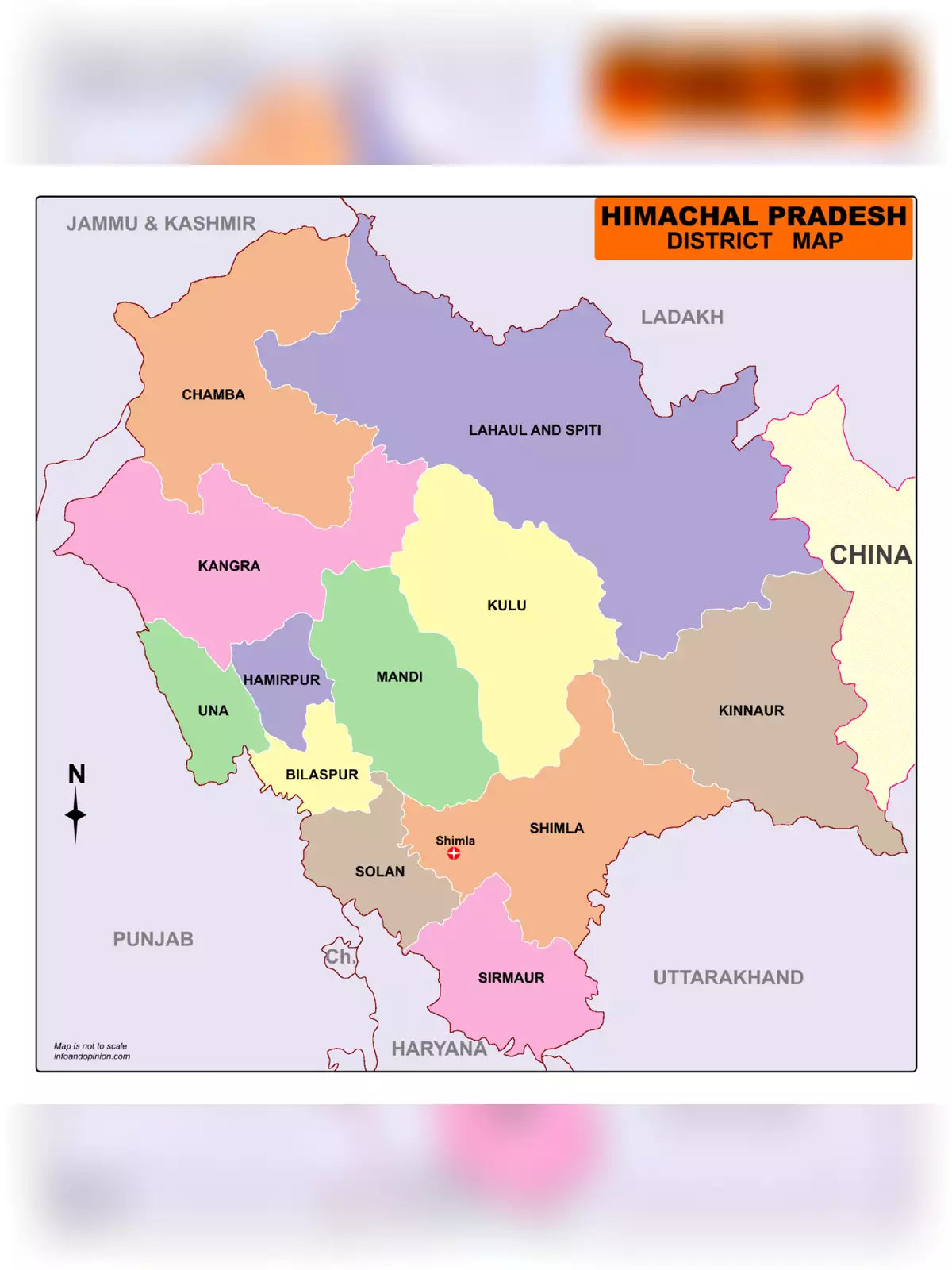
Himachal Pradesh Map - Summary
Himachal Pradesh is a beautiful state in north India that offers much for those wanting to explore the stunning Himalayas. This state is one of the eleven mountain states in India and is known for its unique landscape, filled with towering peaks and vast river systems. Himachal Pradesh borders the Union territories of Jammu and Kashmir and Ladakh to the north. To the west, it shares its borders with Punjab, while Haryana lies to the southwest. Uttarakhand and Uttar Pradesh are to the south, and to the east, it has an international border with the Tibet Autonomous Region in China.
You can download the Himachal Pradesh Map in PDF format using the link given below.
Discover the Beauty of Himachal Pradesh
Himachal Pradesh is not just a destination; it’s an adventure waiting to happen. The state is famous for its breathtaking natural beauty, making it a popular spot for tourists from around the world. From the picturesque valleys to the snowy peaks, there’s so much to see and do here!
Explore the Culture and Heritage
As you explore Himachal Pradesh, you’ll also get a chance to experience its rich culture and heritage. The local people are warm and welcoming, and their traditional customs add to the charm of this state. Be sure to try the delicious local cuisine and enjoy the vibrant festivals celebrated throughout the year.
Remember, the Himachal Pradesh Map is available for you to download in PDF format. Just click on the link below to get your copy and start planning your trip to this magnificent state! 🗺️
Himachal Pradesh Map PDF Download
RELATED PDF FILES-
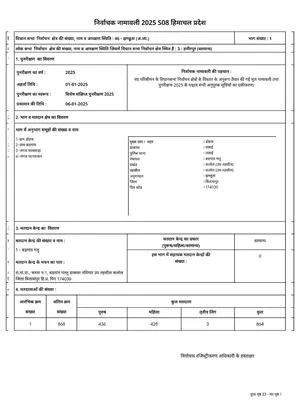 Voter List 2026 Himachal Pradesh
-
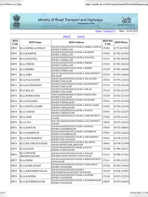 List of All RTO Code Himachal Pradesh
-
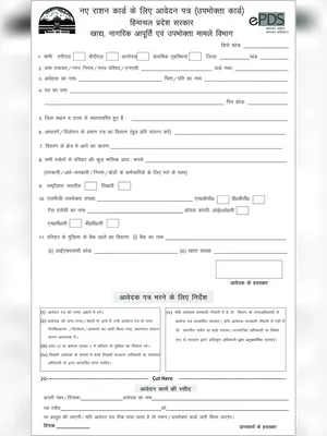 Himachal Pradesh Ration Card Application Form Hindi
-
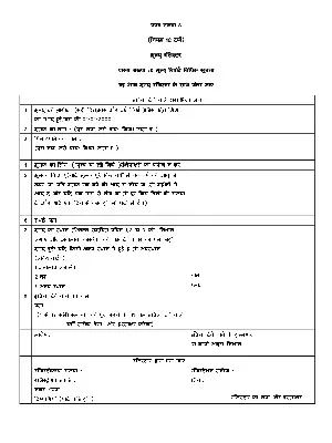
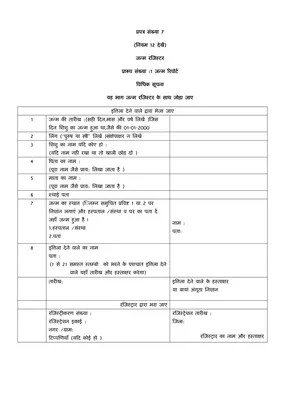 Himachal Pradesh Birth Certificate Form (HP जन्म प्रमाण पत्र फॉर्म) Hindi
-
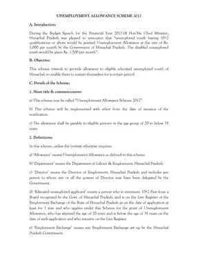 Himachal Pradesh Berojgari Bhatta yojana Form & details
-
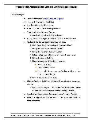 Procedure For Apply Domicile Certificate Form Himachal Pradesh
-
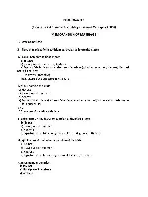 Himachal Pradesh Marriage Certificate Form
-
 Himachal Pradesh Death Certificate Form Hindi