Delhi NCR Map 2026 - Summary
Delhi NCR (National Capital Region) HD Map PDF is ready for download from the link provided at the bottom of this page. The Delhi NCR region is a lively metropolis that includes Delhi and nearby urban areas in Haryana, Uttar Pradesh, and Rajasthan.
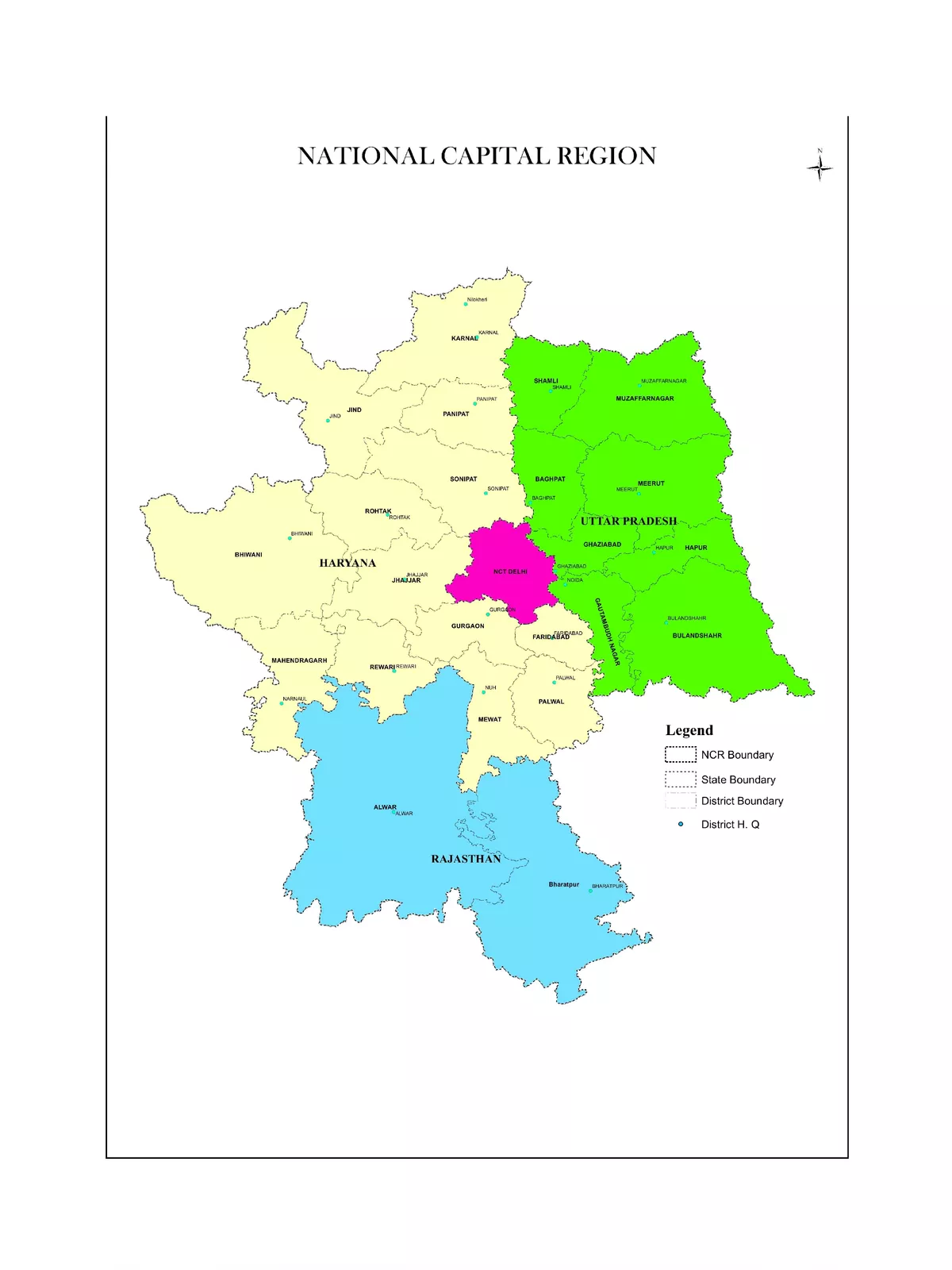
In this comprehensive Delhi NCR High-Resolution Map PDF, you will find district-wise names of the states: Haryana, Rajasthan, Uttar Pradesh, and various zones within NCR. Currently, NCR is regarded as India’s largest and the world’s second-largest urban agglomeration, with a staggering population exceeding 54 million people.
Delhi NCR Map HD District Wise
National Capital Territory of Delhi – This includes both Delhi and New Delhi.
Haryana – The districts included in the NCR are:
- Bhiwani
- Faridabad
- Gurgaon
- Jhajjar (Jhajjar and Bahadurgarh)
- Mahendragarh
- Panipat
- Rewari
- Rohtak
- Sonipat
- Mewat
- Palwal
- Jind
- Karnal
Uttar Pradesh – The districts included in the NCR are:
- Baghpat
- Bulandshahr
- Gautam Buddha Nagar District (Noida and Greater Noida)
- Ghaziabad
- Muzaffarnagar
- Meerut
- Hapur
Rajasthan – The districts included in the NCR are:
- Alwar
- Bharatpur
Zones of NCR
NCT-Delhi has an area of about 1,483 sq km, while Central NCR (CNCR) spans around 2,000 sq km.
The following suburbs are part of NCR:
- Faridabad-Ballabgarh Complex
- Ghaziabad-Loni-Bulandshahr Complex
- Gurgaon-Manesar Complex
- Noida-Greater Noida Complex
- Sonipat-Bahadurgarh Complex
- Sonipat-Kundli Complex
Download the Delhi NCR Map
You can easily download the Delhi NCR Map PDF using the link below. Enjoy exploring this vibrant region! 🗺️