Rajasthan Map - Summary
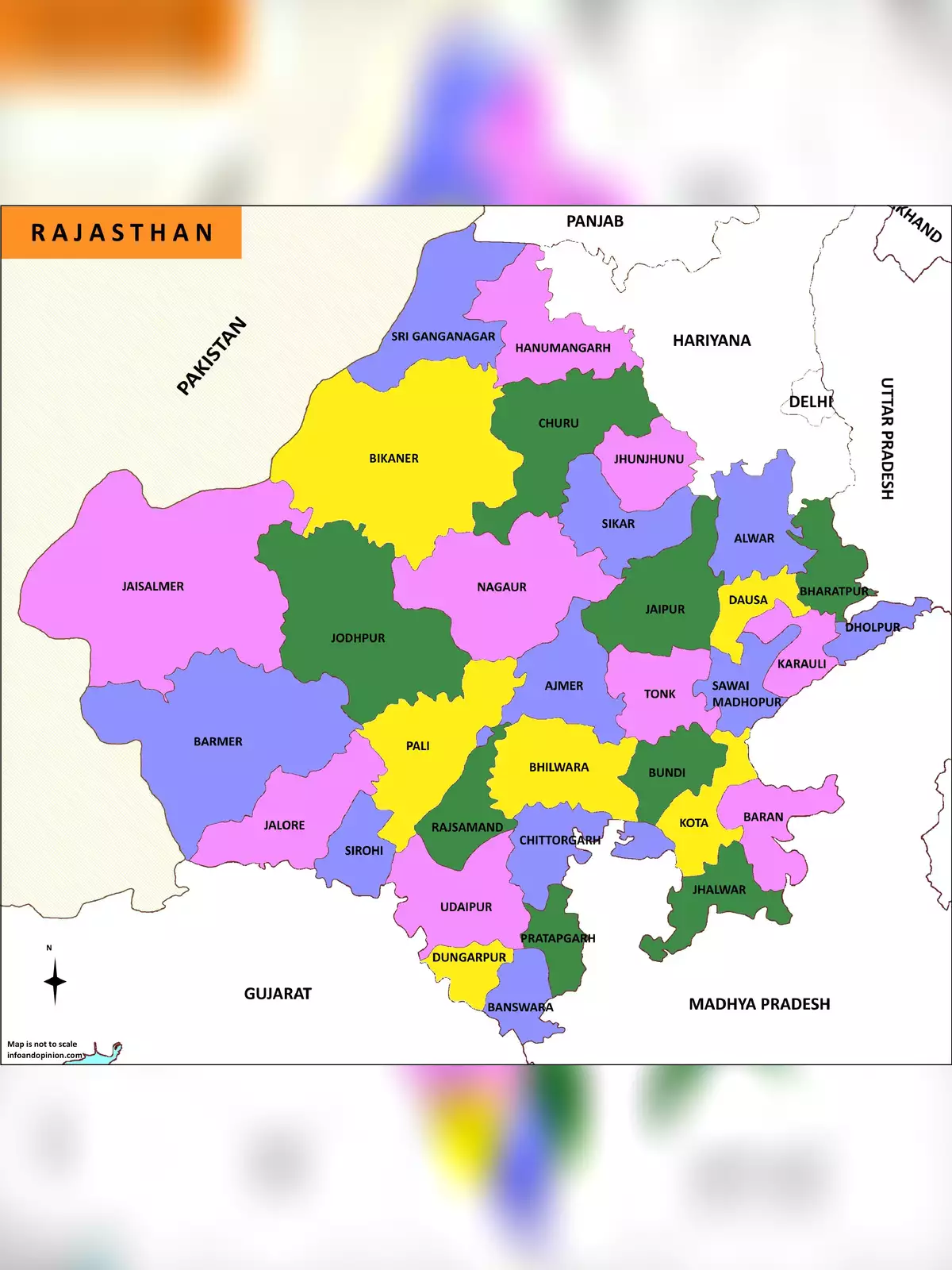
Rajasthan is an incredible state in the northwest of India. Known for its vibrant culture and rich history, Rajasthan is the largest state in India, covering about 11% of the total land area of the Indian subcontinent. This beautiful state came into its current form on November 1, 1956.
The borders of Rajasthan are quite fascinating! To the west and northwest, it shares a boundary with Pakistan. On the north and northeast sides, it is bordered by Punjab, Haryana, and Uttar Pradesh. Meanwhile, Gujarat is located to the southwest, and Madhya Pradesh lies to the southeast.
Discover the Beauty of Rajasthan with Our Maps
Rajasthan is not just about its size but also about the wonderful experiences it offers. Understanding its geography is essential, and you can explore it further by checking out our special maps. These maps can help you plan your visit and discover all that this amazing state has to provide.
Important Maps for Your Travel Adventure
Also Check:
– Rajasthan Road Map
– Rajasthan Administrative Division Map
– Rajasthan Tourist Map
You can easily download the Rajasthan Map in PDF format using the link given below. Get your copy today and make your travels hassle-free!