London Tube Map - Summary
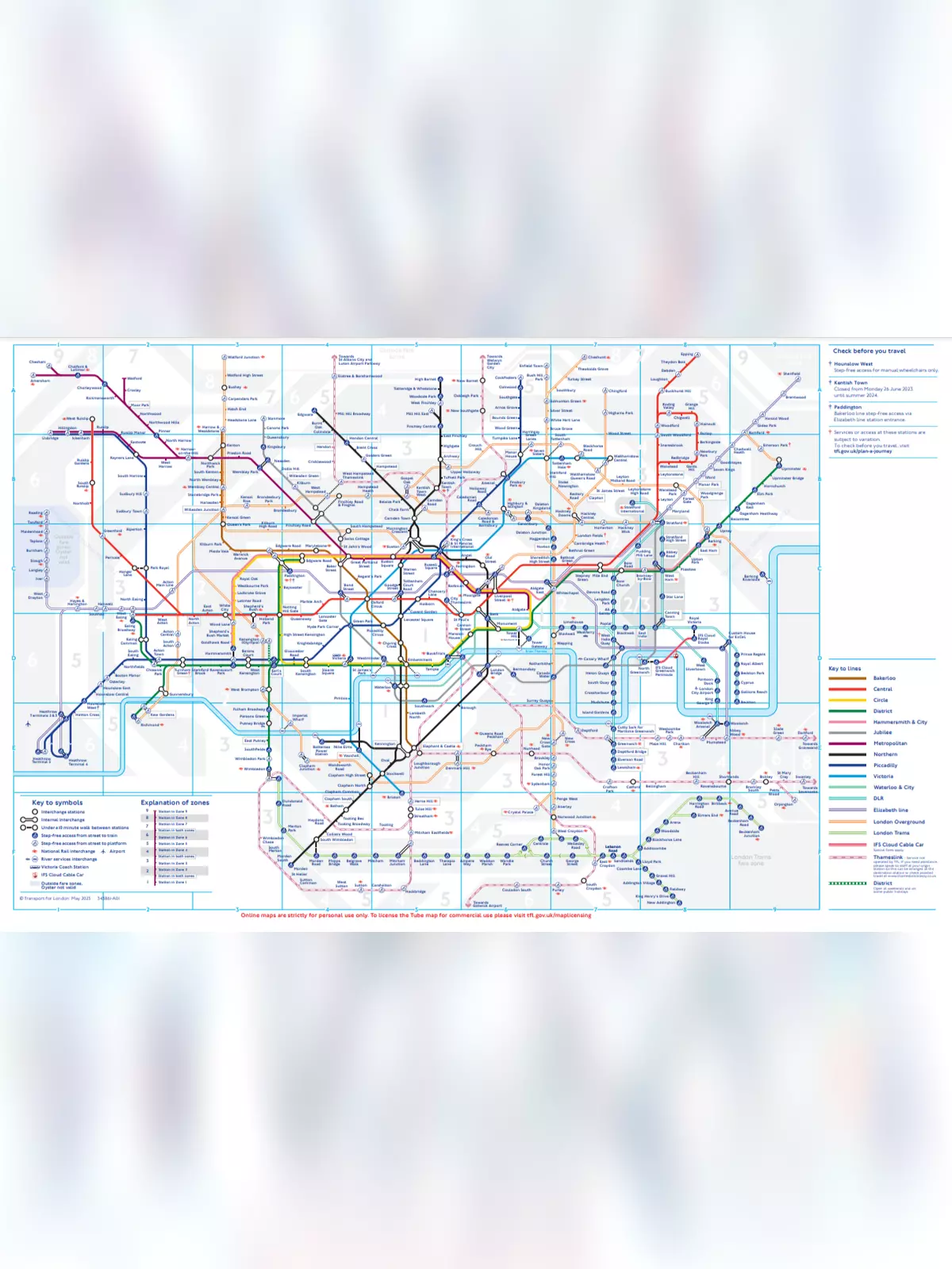
The London Tube map is a vital tool for navigating the underground railway system of London, officially known as the London Underground or simply “the Tube”. This map simplifies the complex transport network by showing the lines, stations, and services clearly. Created by Harry Beck in 1931, the first schematic Tube map has since evolved to incorporate various public transport options in London, including the Docklands Light Railway, London Overground, the Elizabeth line, Tramlink, the London Cable Car, and Thameslink.
Understanding the History of the London Tube Map
In the early days, London’s transport was run by many independent companies, which meant there were no overall maps available. People could only find maps for specific routes related to individual companies. These early maps were not schematic; instead, they overlaid the train lines onto regular street maps, making it difficult for people to see how the services connected. There was no effort to combine the companies’ services or collaborate on advertising, leading to confusion.
Iconic Design of the Tube Map
The Tube map has earned recognition as one of Britain’s top 10 design icons, standing alongside famous creations like Concorde, the Mini, the Supermarine Spitfire, the K2 telephone box, the World Wide Web, and the AEC Routemaster bus. Since 2004, Art on the Underground has invited artists to design covers for the handy pocket Tube map, adding an artistic touch to this essential travel guide.
- UERL lines:
- Bakerloo Railway – brown
- Hampstead Railway – indigo
- Piccadilly Railway – yellow
- District Railway – green
- Other lines:
- Central London Railway – blue
- City and South London Railway – black
- Great Northern and City Railway – orange
- Metropolitan Railway – red
You can easily download the London Tube Map PDF using the link provided below.