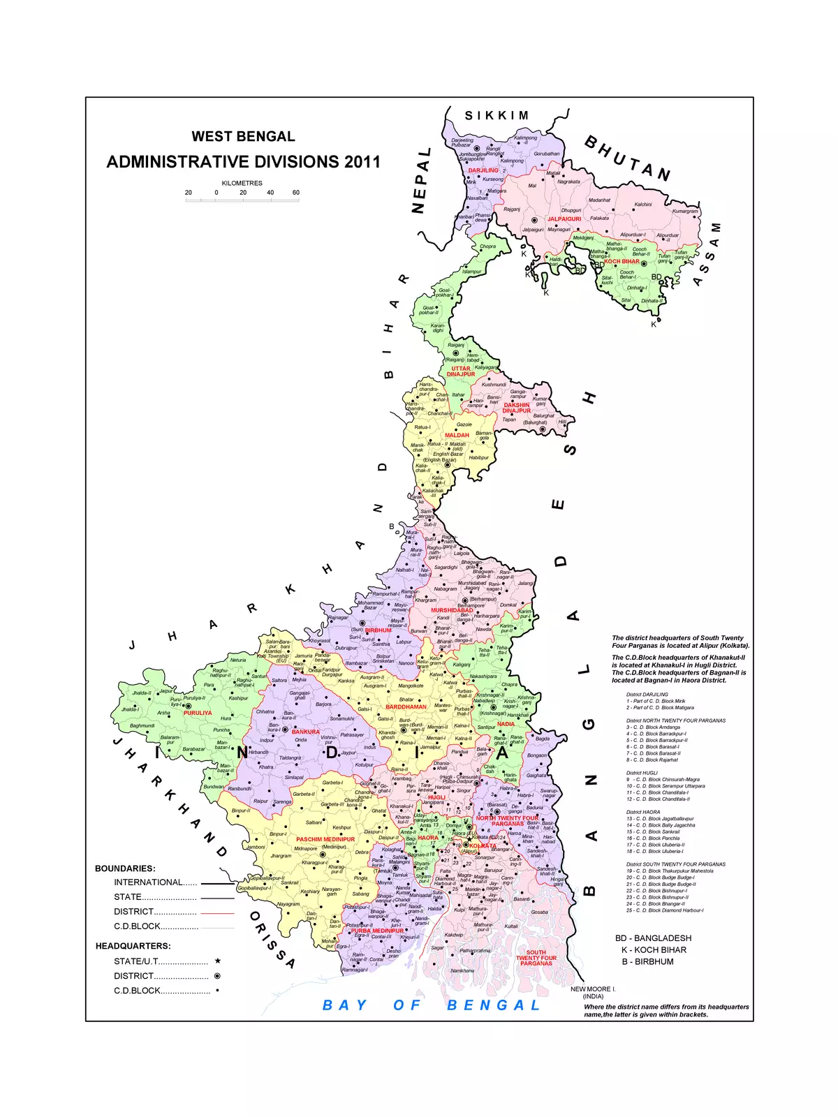
West Bengal Map - Summary
West Bengal is an Indian state located in eastern India. This vibrant state stretches from the Bay of Bengal in the south to the majestic Himalayan mountain ranges in the north. Kolkata, the capital, is not only the largest city in West Bengal but also a cultural hub. In Bengali, it is known as Paschim Banga. The total area of West Bengal is approximately 34,267.3 square miles or 88,752 square kilometers.
Understanding the Geography of West Bengal
West Bengal boasts a rich and diverse landscape. From beautiful beaches to rolling hills and lush forests, the state offers a variety of natural wonders.
Importance of the West Bengal Map
Having a detailed West Bengal map is essential for travelers, students, and anyone interested in exploring this remarkable state. It provides useful insights into the geography, districts, and major attractions.
You can download the West Bengal Map in PDF format using the link given below.