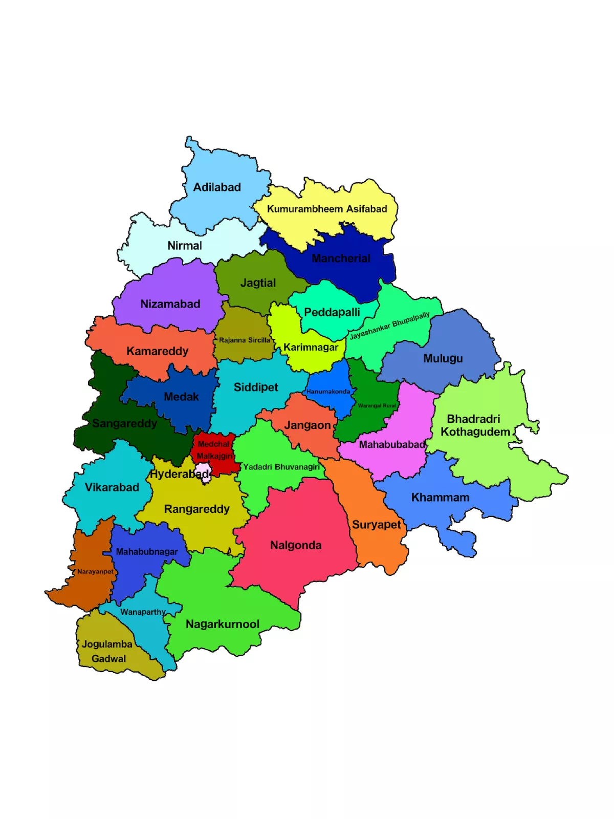
Telangana Map with Districts

❴SHARE THIS PDF❵ FacebookX (Twitter)Whatsapp
REPORT THIS PDF ⚐

Telangana Map with Districts

Telangana State comprises 33 districts covering an area of 1,12,077 sq. km (44,273 sq. mi). The largest district is  Bhadradri Kothagudem whereas Hyderabad is the smallest. Telangana was created by passing the AP State Reorganization Bill in both houses of Parliament. Telangana is surrounded by Maharashtra and Chhattisgarh in the North, Karnataka in the West and Andhra Pradesh in the South and East directions.

The Telangana region was part of the Hyderabad state from 17th September 1948 to 1st November 1956, until it was merged with Andhra State to form Andhra Pradesh. Telangana’s major cities of the State include Hyderabad, Warangal, Nizamabad, Nalgonda, Khammam, and Karimnagar.

Telangana Map with Districts – 33 Districts Name

Adilabad
Bhadradri Kothagudem
Hanumakonda
Hyderabad
Jagtial
Jangaon
Jayashankar Bhupalpally
Jogulamba Gadwal
Kamareddy
Karimnagar
Khammam
Kumuram Bheem
Mahabubabad
Mahabubnagar
Mancherial
Medak
Medchal-Malkajgiri
Mulugu
Nagarkurnool
Nalgonda
Narayanpet
Nirmal
Nizamabad
Peddapalli
Rajanna Sircilla
Rangareddy
Sangareddy
Siddipet
Suryapet
Vikarabad
Wanaparthy
Warangal
Yadadri Bhuvanagiri

You can download the Telangana Map with Districts PDF using the link given below.

Telangana Map with Districts PDF Free Download

REPORT THISIf the purchase / download link of Telangana Map with Districts PDF is not working or you feel any other problem with it, please REPORT IT by selecting the appropriate action such as copyright material / promotion content / link is broken etc. If this is a copyright material we will not be providing its PDF or any source for downloading at any cost.

SIMILAR PDF FILES