Seismic Zone Map India - Summary
Hello, Friends! Today, we are thrilled to present the **Seismic Zone Map India PDF** for your convenience. If you are on the lookout for a high-resolution Seismic Zone India Map PDF, you’ve arrived at the perfect spot! Feel free to download it directly from the link at the bottom of this page.
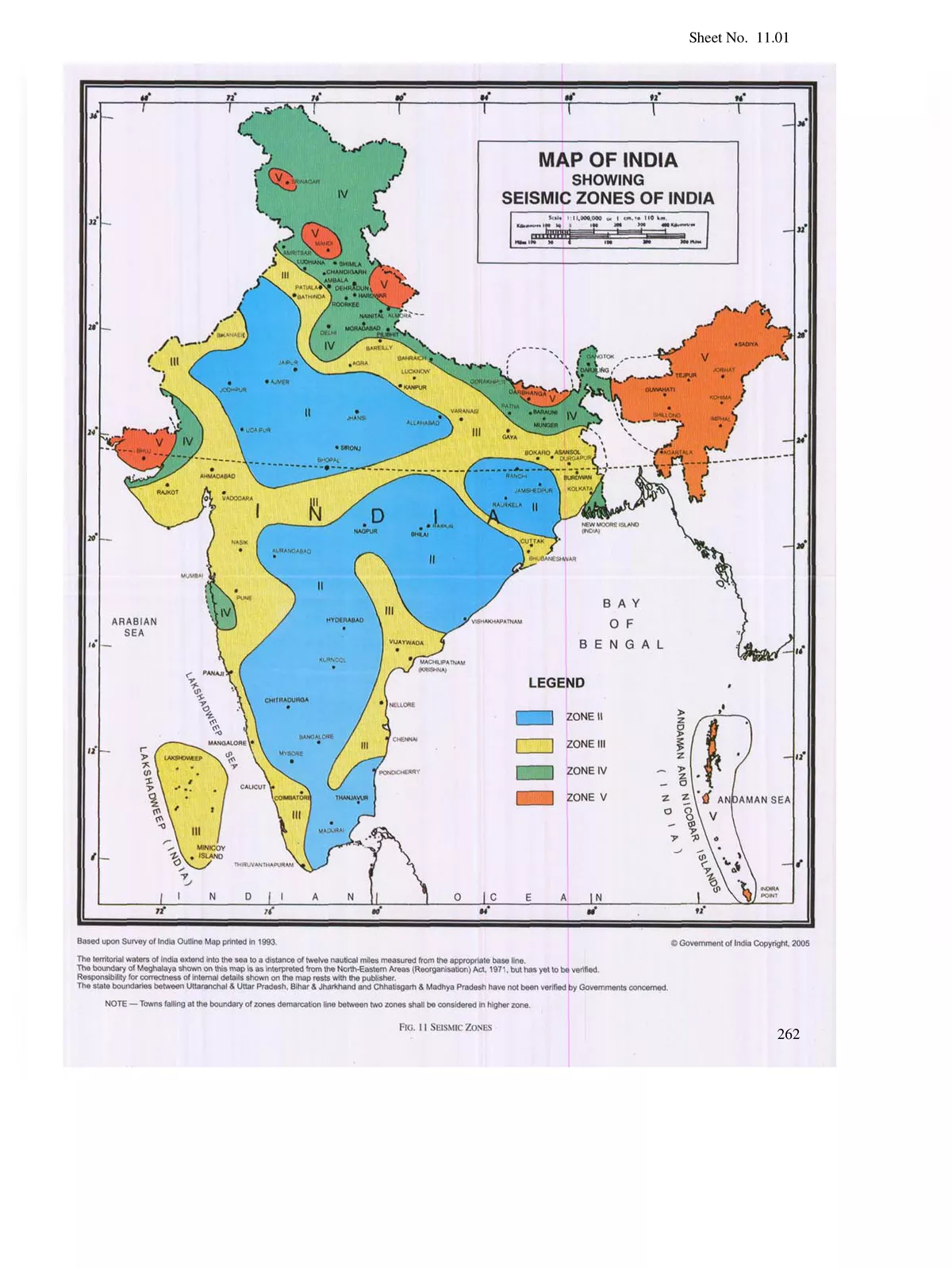
The **Seismic Zone Map India** is a vital tool for planning against natural disasters like earthquakes. This Indian seismic zoning map helps in identifying areas with low, moderate, and high earthquake risks. Such maps are crucial for making informed decisions before constructing high-rise buildings, thereby ensuring safety by assessing the seismic activity in specific regions. Ultimately, this can save lives and protect property in the long run.
Understanding the Seismic Zoning Map India
The Geological Survey of India (G.S.I.) first introduced the seismic zoning map in 1935. Since then, there have been several updates to incorporate new research findings. This map is based on the damage observed in various areas during past earthquakes. It uses colours to highlight four distinct seismic zones across India:
- Zone – II: This zone is known as the least active.
- Zone – III: This zone is classified as having moderate seismic activity.
- Zone – IV: This zone is recognized as a high seismic area.
- Zone – V: This zone is categorized as the highest seismic zone.
You can easily download the Seismic Zone Map India PDF using the link provided below.