Metro Map Hyderabad HD - Summary
Hyderabad Metro Rail (HMR) is the world’s largest Public-Private Partnership (PPP) project in the Metro rail sector. Metro rail and other forms of Mass Rapid Transport System (MRTS) are emerging as prominent infrastructure requirements offering a viable solution to the transportation woes that accompany urban expansion.
The Hyderabad Metro Rail (HMR) Project is an integrated urban transport development project with inter-modal connectivity and convenient skywalks that will mark the beginning of an era of seamless commuting across Hyderabad.
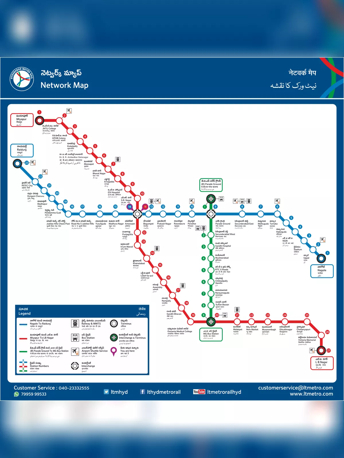
Hyderabad Metro Map (Hyderabad Metro Rail Map)
The Hyderabad Metro Rail Network will cover a total distance of around 69.2 Km across three corridors:
- Red Line (Line 1):
- The Red Line runs from Miyapur to LB Nagar.
- It covers a distance of approximately 29 kilometers.
- Major stations on this line include Ameerpet, Begumpet, Punjagutta, and Parade Grounds.
- Blue Line (Line 2):
- The Blue Line runs from Nagole to Raidurg.
- It spans around 28 kilometers.
- Key stations on this line include Uppal, Tarnaka, Secunderabad East, and HITEC City.
- Green Line (Line 3):
- The Green Line connects JBS (Jubilee Bus Station) to MGBS (Mahatma Gandhi Bus Station).
- It is approximately 11 kilometers long.
- Important stations on this line include MG Bus Station, Victoria Memorial, and Parade Grounds.
Hyderabad Metro Rail Map download in PDF format.