Delhi Metro Route Map - Summary
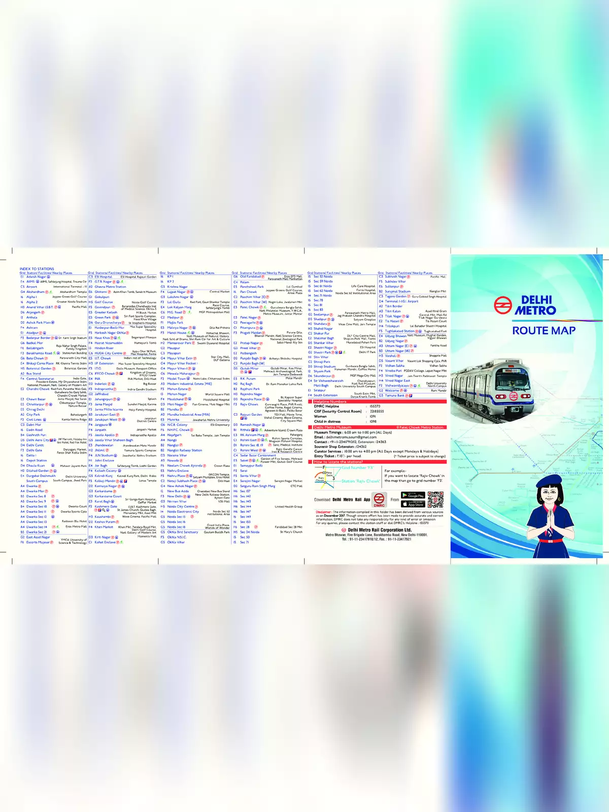
Delhi metro route map is essential for every traveler in India, showcasing the extensive network managed by the Delhi Metro Rail Corporation, a collaboration with the government.
The Delhi metro is not just the largest; it’s also the busiest metro system in India, serving millions of passengers every day.
Metro Route System in Delhi NCR
The Delhi metro route map is a crucial part of the rapid transit system that connects the city of Delhi with the National Capital Region (NCR). This region includes cities like Ghaziabad, Faridabad, Gurgaon, Noida, and Bahadurgarh. Presently, the Delhi Metro route map boasts 229 active stations, making it incredibly convenient for people to travel throughout the area. Here, you can discover valuable information about the Delhi Metro, including details about metro lines, train start and end points, the route map, and the top attractions to visit along the lines.
Metro Lines in Delhi NCR
There are several lines in the Delhi NCR region:
- The first operation began in 2002, connecting Welcome station to Tis Hazari station on the red line.
- The Delhi metro route serves not only the city of Delhi but also nearby NCR cities like Gurgaon, Noida, Faridabad, Ghaziabad, and Bahadurgarh.
- At present, the Delhi metro route map features around 10 to 12 active metro lines, covering nearly 350 kilometers of tracks.
Follow the link to download the Delhi Metro Route Map PDF available below this post. This PDF includes all the necessary details for your travel needs! 📄