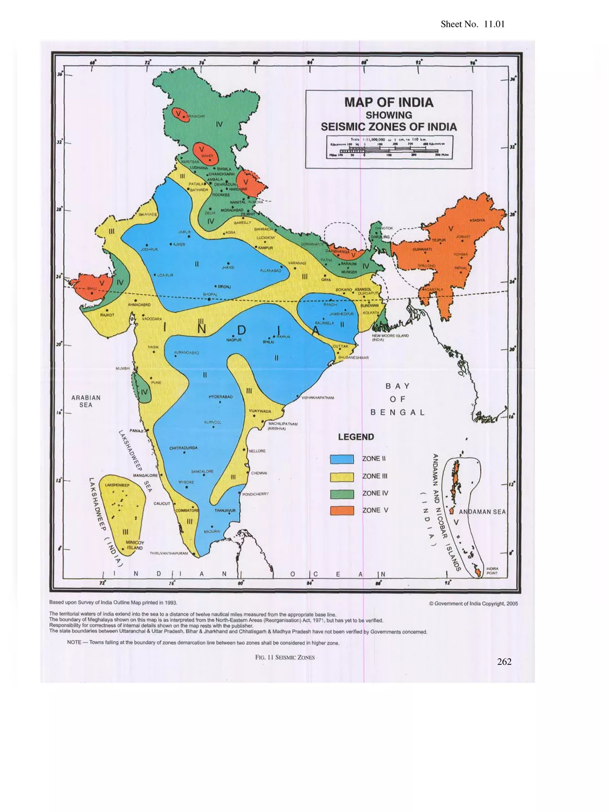
Seismic Zone Map India
Hello, Friends today we are sharing with you Seismic Zone Map India PDF to help you. If you searching Seismic Zone India Map PDF in high resolution then don’t worry you have arrived at the right website and you can directly download from the link given at the bottom of this page.
Seismic Zone Map India Map helps them in planning for a natural disaster like an earthquake. An Indian seismic zoning map assists one in identifying the lowest, moderate as well as highest hazardous or earthquake-prone areas in India. Even such maps are looked into before constructing any high-rise building so as to check the level of seismology in any particular area. This in turn results in saving lives in the long run.
Seismic Zoning Map India
The Geological Survey of India (G. S. I.) first published the seismic zoning map of the country in the year 1935. With numerous modifications made afterward, this map was initially based on the amount of damage suffered by the different regions of India because of earthquakes. Color-coded in different shades of the color red, this map shows the four distinct seismic zones of India. Following are the varied seismic zones of the nation, which are prominently shown on the map:
- Zone – II: This is said to be the least active seismic zone.
- Zone – III: It is included in the moderate seismic zone.
- Zone – IV: This is considered to be the high seismic zone.
- Zone – V: It is the highest seismic zone.
You can download the Seismic Zone Map India PDF using the link given below.