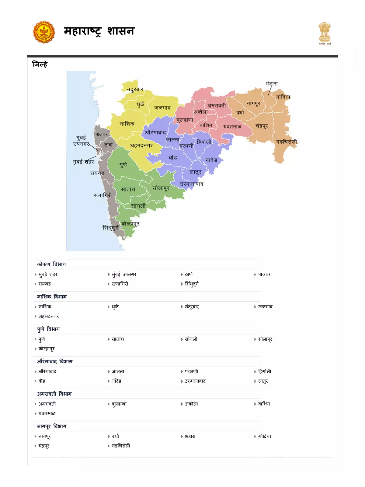
Maharashtra District Map
Maharashtra District located in india in the western part, it’s a third largest state in country. Maharashtra shares various borders that are Gujarat, Madhya Pradesh, Chhattisgarh, Telangana, Karnataka, Goa and the Union Territory of Dadra and Nagar Haveli and Daman and Diu. Arabian sea also lies on the western side of state.
Its is a home of the one of the largest film industries of the world i.e., Bollywood also contribute the national industrial output.
Places to visit in Maharashtra District
There are various places to hangout in this state. Some of them include Mahabaleshwar, Khandala, Panchgan, Lonavala, Matheran, Ellora, Elephanta Caves, Chhatrapati Shivaji Terminus and UNESCO World Heritage Sites of Ajanta
Great Time to Visit in Maharashtra District
Mosoon is the one of the best time to visit the hills in state including Mahabaleshwar, Toranmal, Lonavala and Chikhaldar but if you don’t like rain than you can visit between October and March.
Download the updated Maharashtra district map in PDF format following the link given below and know more about Maharashtra.