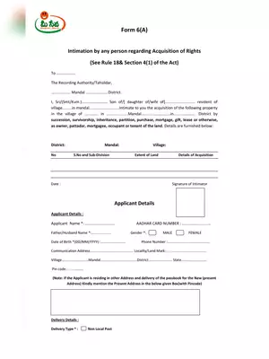
Dharani Survey Proforma
If you are searching for the Dharani Survey Proforma in PDF format than you are at the right website. This is a proforma for Dharani Survey for every property in the State, both agricultural and non-agricultural, for incorporating them into the Dharani portal, an online platform for accessing all land-related records.
The orders of the Chief Secretary explained that the government had decided to incorporate the basic values of agricultural and non-agricultural properties on the Dharani portal to enable property owners to know them directly without anyone’s intervention.
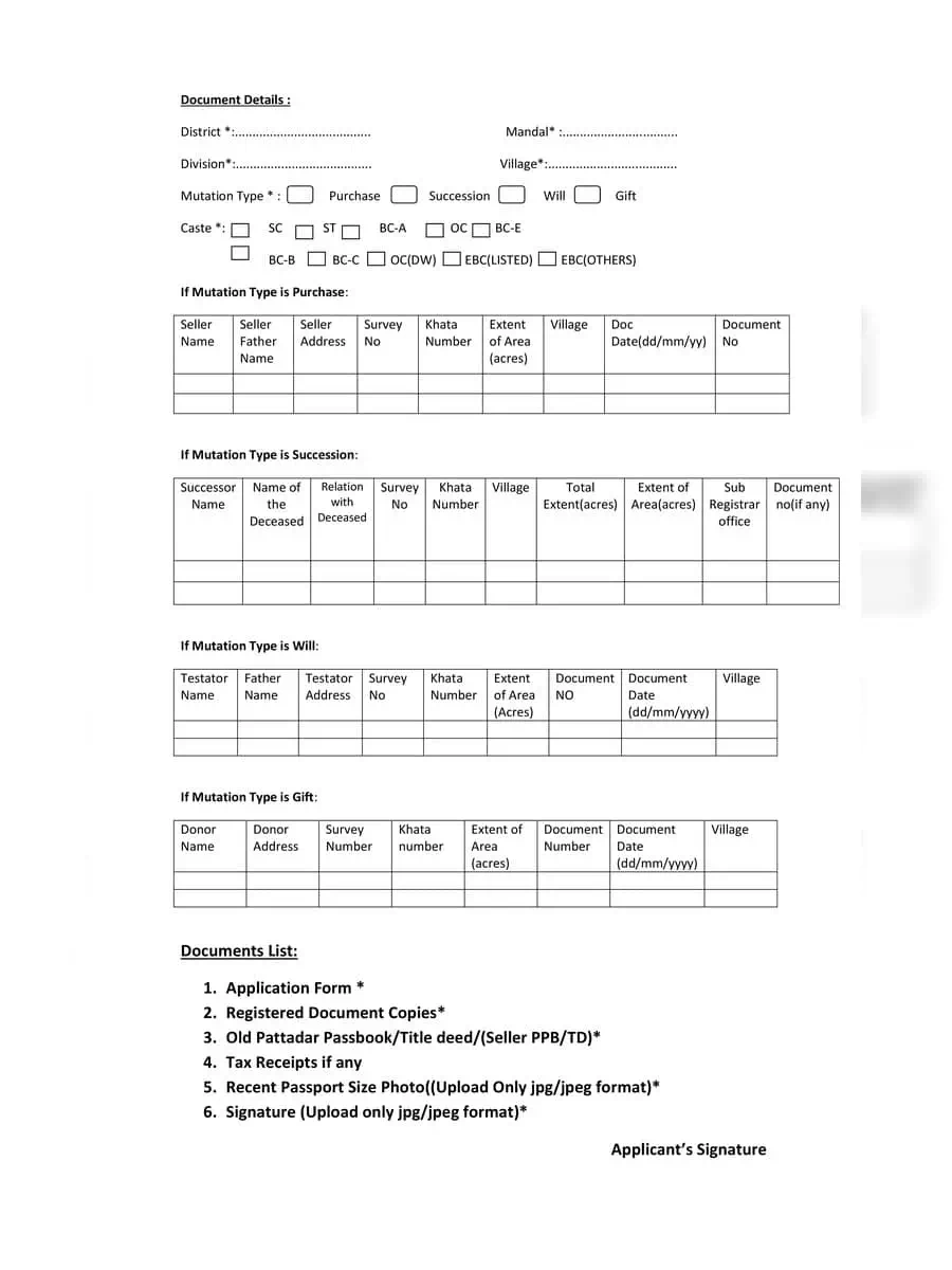
Documents Required for Dharani Survey Proforma
- Application Form
- Registered Document Copies
- Old Pattadar Passbook/Title deed/(Seller PPB/TD)
- Tax Receipts if any
- Recent Passport Size Photo((Upload Only jpg/jpeg format)
- Signature (Upload only jpg/jpeg format)
Dharani Survey Proforma (Details)
Chief Secretary Somesh Kumar issued orders, seeking basic value details of agricultural and non-agricultural properties that the gram panchayats and urban local bodies (ULBs) other than Greater Hyderabad Municipal Corporation (GHMC) and the GHMC itself were supposed to furnish to sub-registrar offices (SROs) for updating on Dharani.
Officials said the basic values of properties had not been revised after the formation of Telangana state. Hence, the values fixed by committees headed by Revenue Divisional Officers in rural areas and Joint Collectors in urban local bodies in 2013 would hold good. The committees used to revise the values twice a year in combined Andhra Pradesh prior to 2013. In the wake of Mr. Somesh Kumar’s orders, Director of Municipal Administration N. Satyanarayana directed all municipal commissioners in the State to ensure that the revenue ward/block wise information of buildings and lands was furnished to SROs.
You can download the Dharani Survey Proforma in PDF format using the link given below.
SIR/MADAM I LIVE ABROAD. NOE DUE TO COVID I CANT TRAVEL. MY DOCUMENTS ARE IN INDIA. IM IN UK, WHAT DO I DO
Sir/madam
Is this survey for Agricultural land? In documents section Title deed indicates what? Is it of constructed/plot previous land or agricultural land of owner at some other place?