World Physical Map
A world physical map is a visual representation of the physical features of the world, including mountains, rivers, oceans, and deserts.
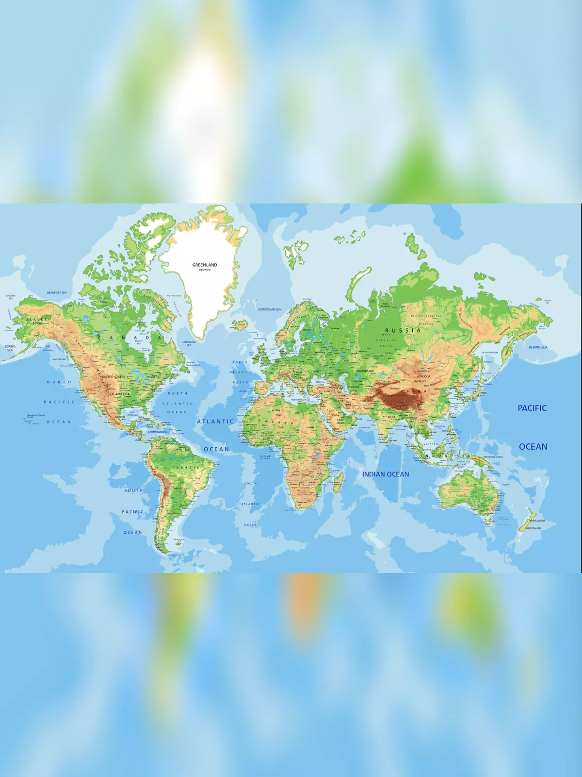
The map shows various extreme points and other important features of the Earth, such as continents, oceans and large islands, deserts, mountains, countries, and capital cities. The surface of the Western Hemisphere of the Earth with South America in the center and Antarctica at the bottom.
A physical map is able to depict the natural physical attributes of a geographical area. It depicts the location and physical features of the landscape like mountains, rivers, valleys, deserts, lakes, streams, seas, and oceans. These maps generally show things like mountains, rivers, and lakes. Bodies of water are commonly shown in blue. Mountains and elevation changes are sometimes shown with different colors and shades to show elevation.
World Physical Map
- The total area of the earth’s surface (land and water) is slightly more than 510 million km² at sea level (100%). Approximately 360 million km² are water, the salty liquid between the dry land (almost 71%).
- The rest, about 29% of the planet’s surface, is dry land, rock, stones, sand, mountains, deserts, rivers and lakes, arable land, etc. The total land area, including Antarctica, is about 150 million km².
- The highest point on Earth, measured from sea level, is the summit of Mount Everest. The mountain, also known as Chomolungma, peaks at 8,848 m (29,029 ft; its snow-ice cover included). The Earth’s highest mountain is located in the Himalayan Range on the border of Nepal and China.
- The highest navigable lake is Lake Titicaca. The biggest lake in South America is located in the Andes at an elevation of 3,812 m. 27 rivers feed Lake Titicaca; the border between Bolivia and Peru runs through the lake.
- The Pacific Ocean is, with an area of approximately 165 million km², the largest body of water; it lies between the Americas (North and South America) on the east and Asia and Australasia on the west.
- The Atlantic Ocean, the world’s second-largest ocean with an area of almost 80 million km², lies between the Americas on the west and Europe and Africa on the east.
- The Indian Ocean is the third-largest of the five oceans; it covers about 70.5 million km².