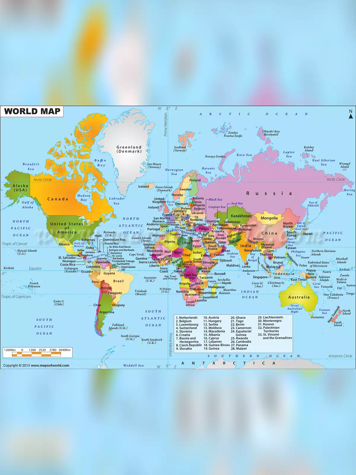
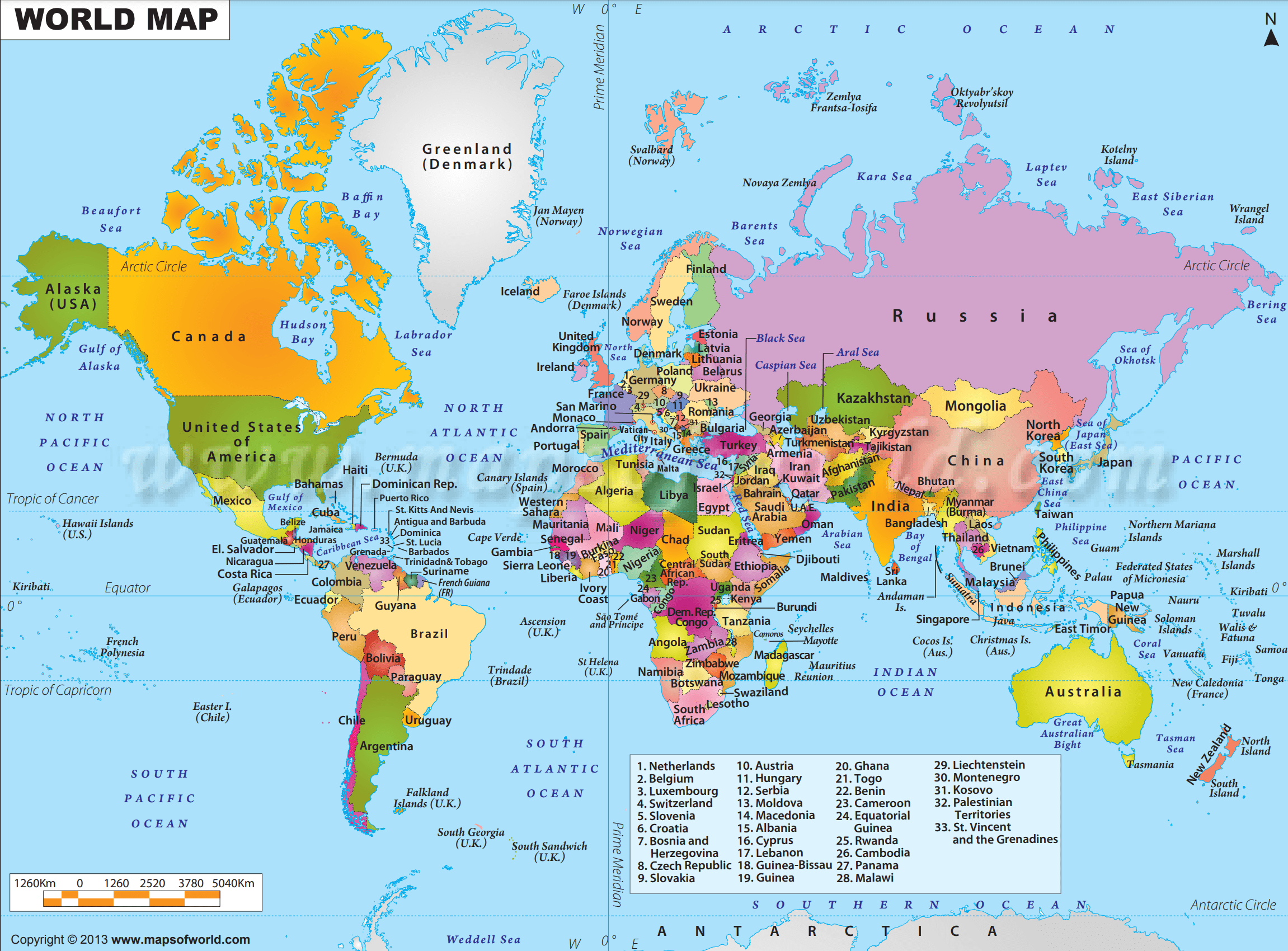
World Map
World Map (High Resolution)
Download the High-resolution PDF of the political map of the world centered on Europe and Africa. The map shows the location of most of the world’s countries and includes their names where space allows. Representing a round earth on a flat map requires some distortion of the geographic features no matter how the map is done.
The high-resolution world map below is a two-dimensional (flat) projection of the global landmass and oceans that cover the surface of our spherical planet. The world map shows the continents, oceans, major countries, and a network of lines representing meridians and parallels, the geographic coordinate system.
- Download World Maps
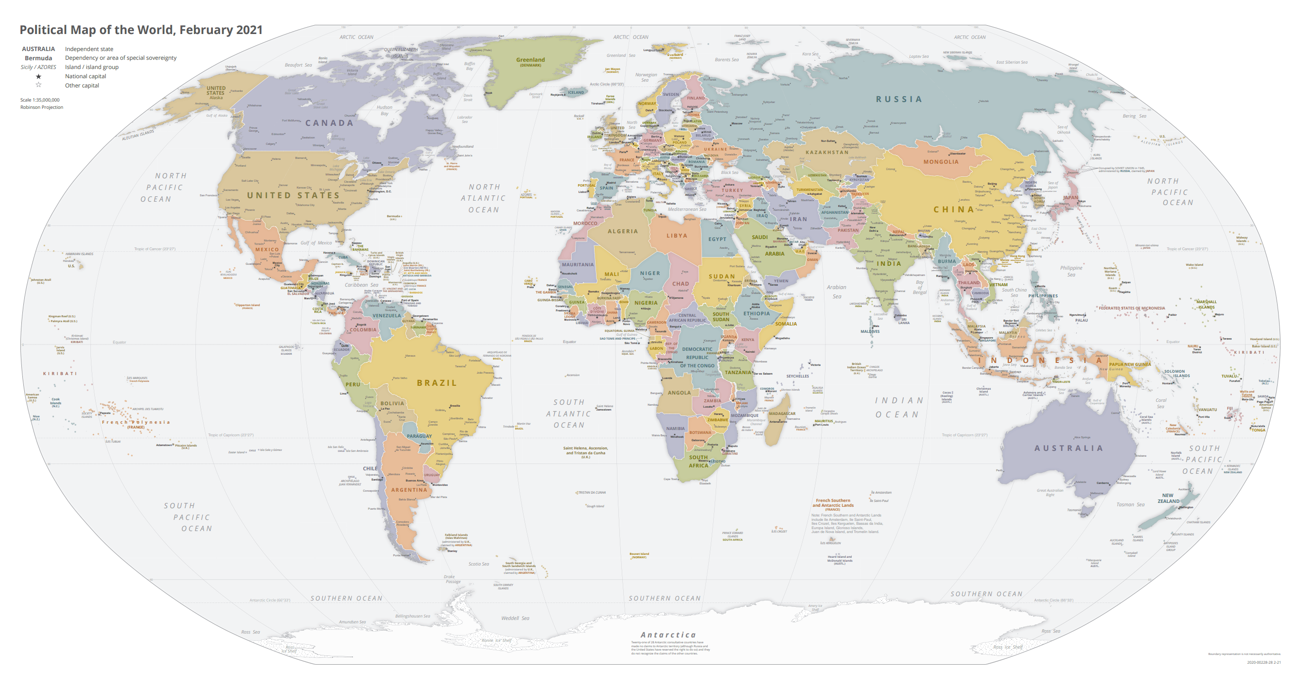
- Political Map of the World, November 2021
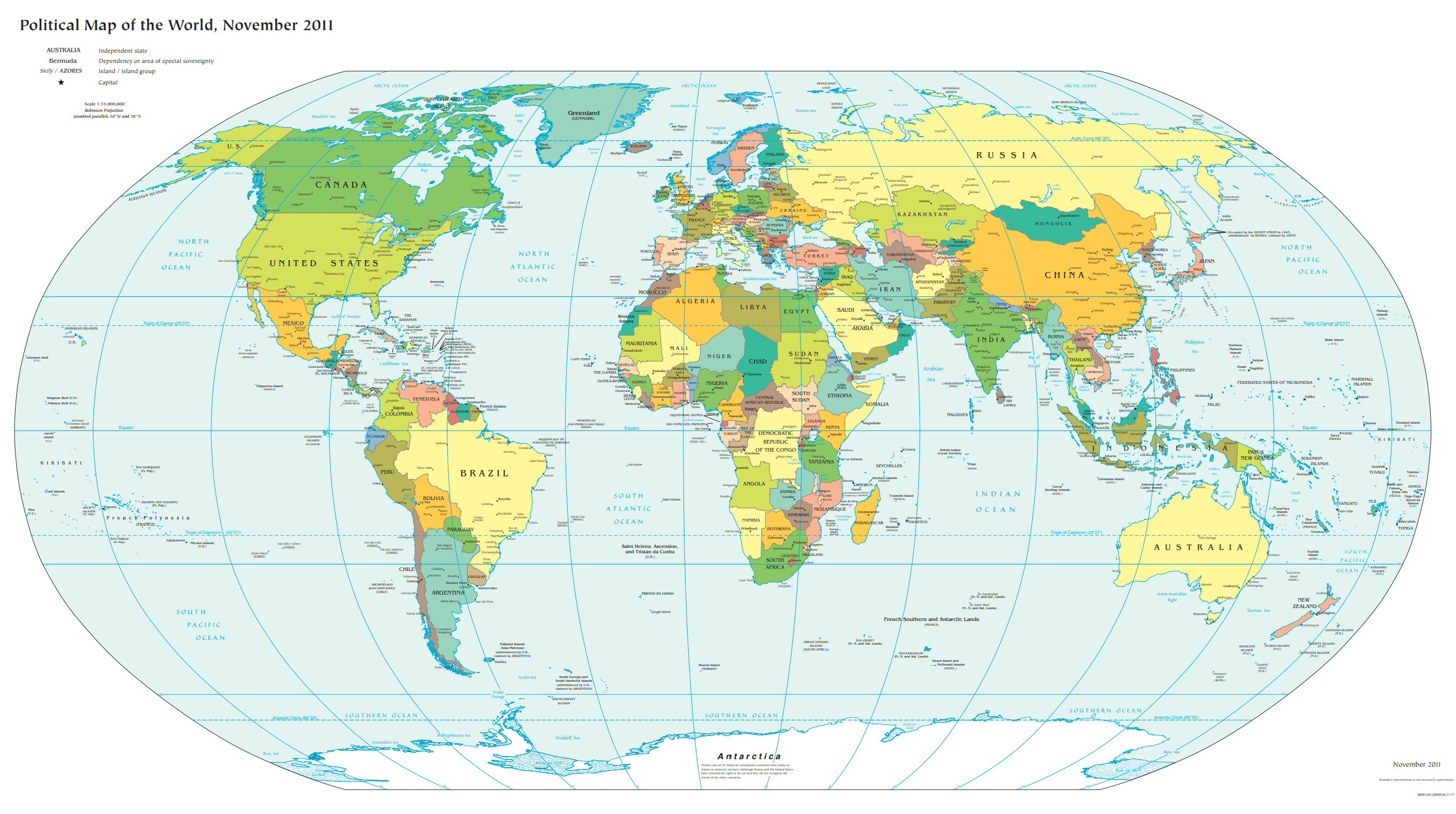
- Political Map of the World, November 2011
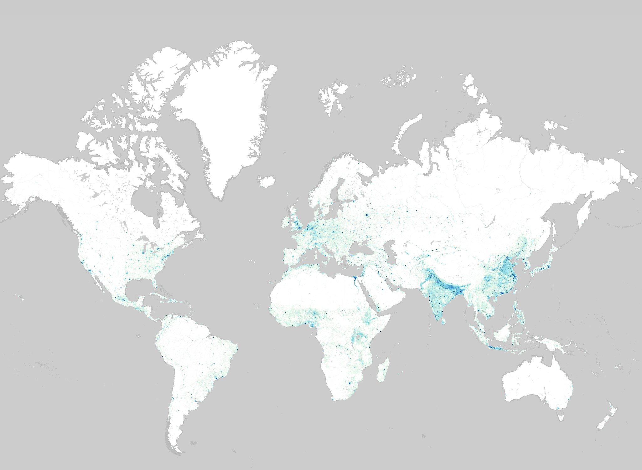
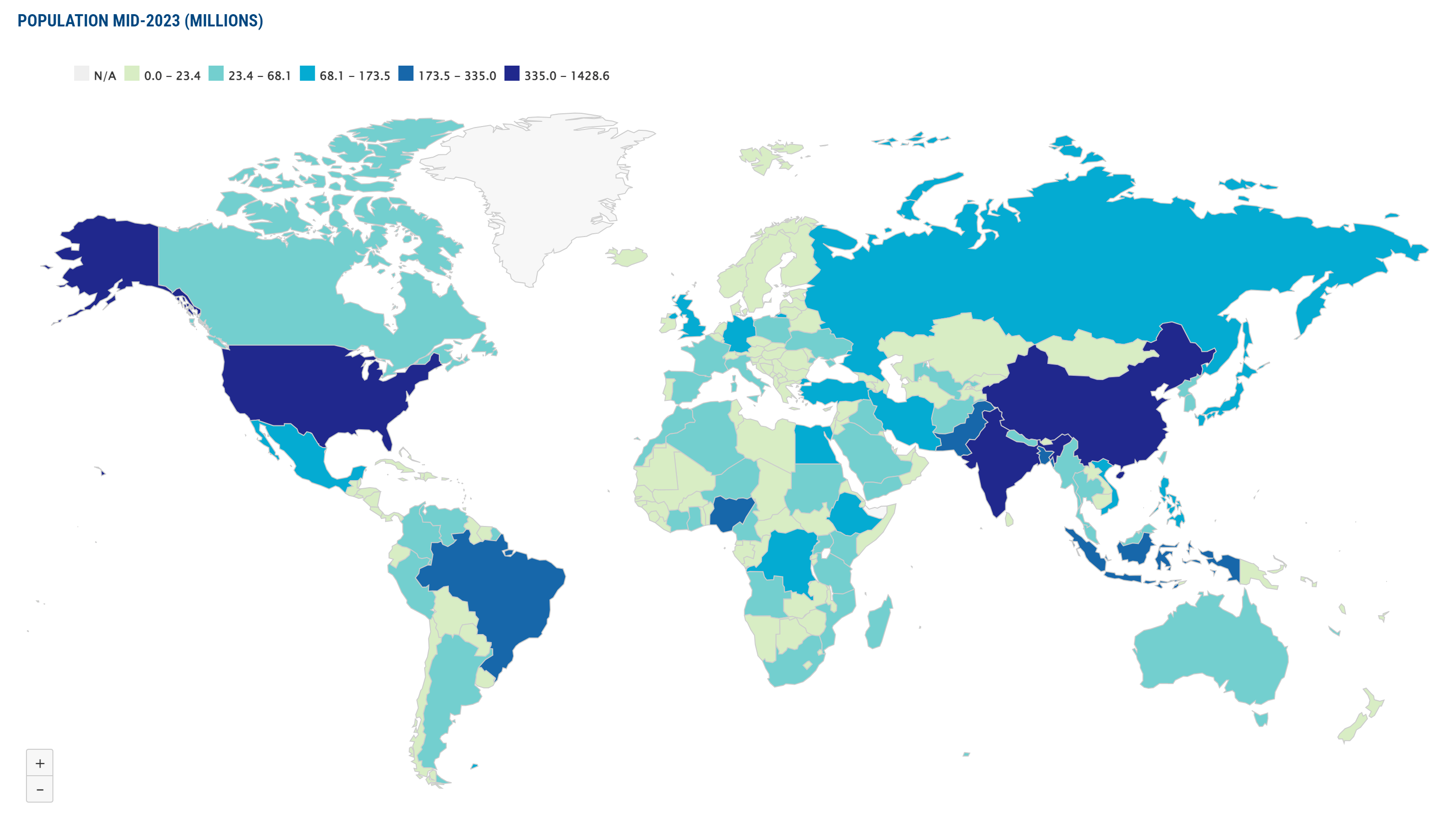
- Population Maps of World
- Printable World Map with Countries Names
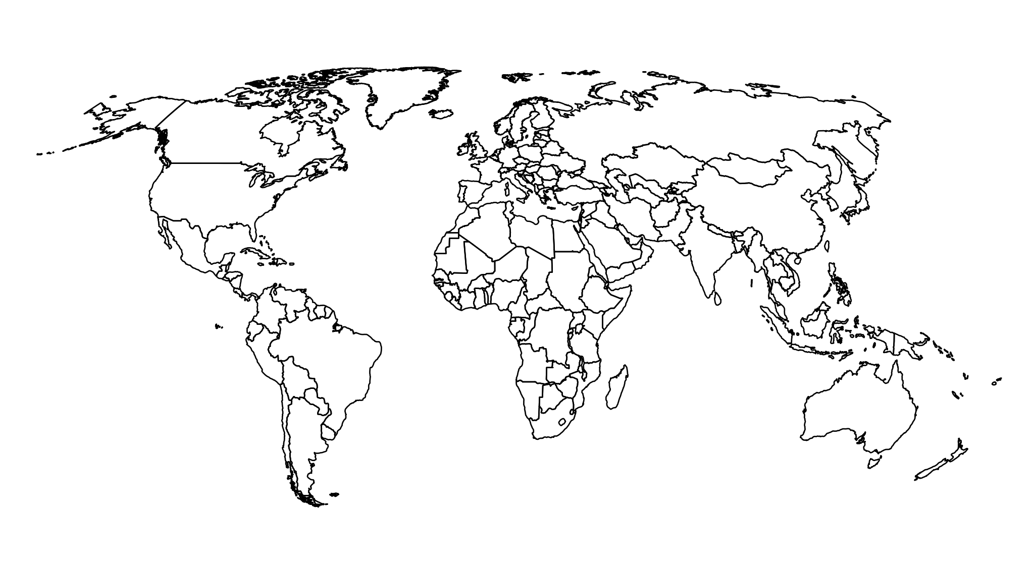
- Blank Outline World Map
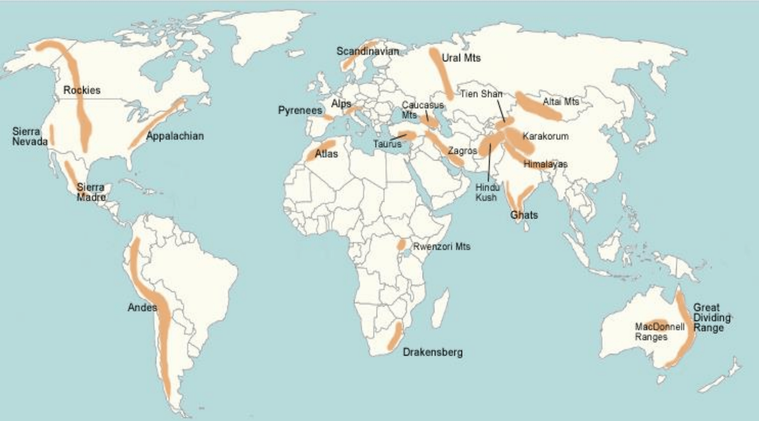
- World Map with Major Mountain Ranges
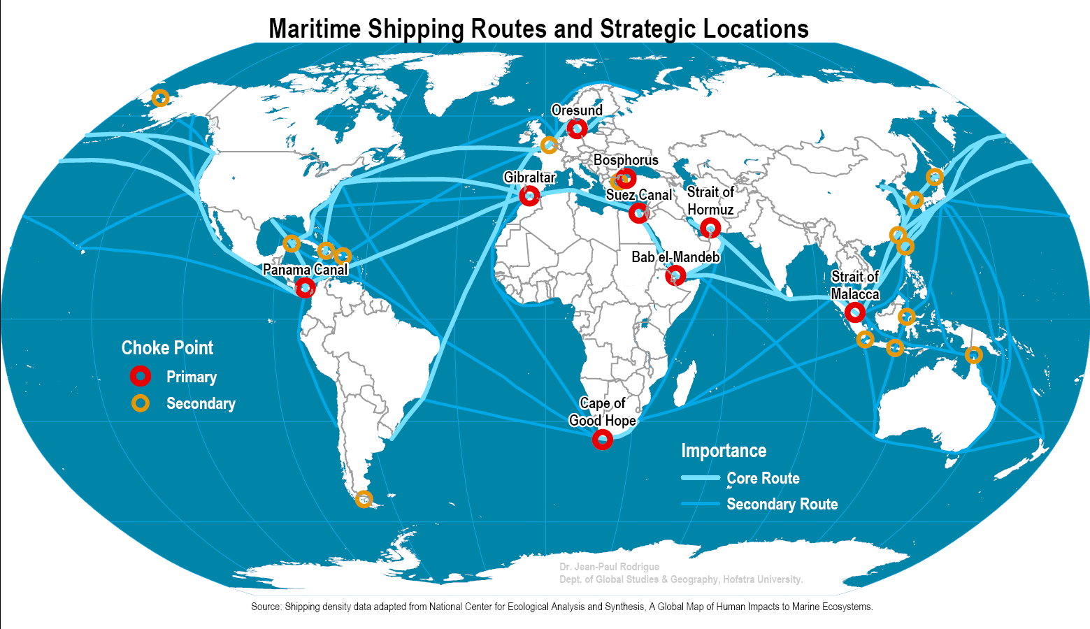
- World Map with Major Maritime Shipping Routes
- Map of Ancient World
- Uses of Different World Maps
- World Map – Countries List
Download World Maps
Welcome to our treasure trove of high-quality, freely downloadable world maps! Whether you’re a student, traveler, educator, or researcher, these maps offer invaluable insights into our planet’s diverse landscapes, populations, and geographical features. Dive into this collection and unlock a wealth of knowledge at your fingertips.
Here are different world maps in high resolution vector format which you can download based on your requirements.
Political Map of the World, November 2021
Political Map of the World, November 2011
Population Maps of World
Printable World Map with Countries Names
Blank Outline World Map
World Map with Major Mountain Ranges
World Map with Major Maritime Shipping Routes
Map of Ancient World
Uses of Different World Maps
Population Maps
- Demographic Analysis: Understand global population trends, densities, and distributions for research, policymaking, and urban planning purposes.
- Cultural Studies: Explore the diversity of human cultures and societies by examining population concentrations and demographic characteristics.
Physical Maps
- Geographical Exploration: Discover the Earth’s natural features, including continents, oceans, deserts, and forests, to deepen your understanding of physical geography.
- Environmental Studies: Analyze landforms, climate patterns, and ecosystems to study environmental processes, conservation efforts, and climate change impacts.
Mountain Range Maps
- Adventure Planning: Plan hiking, trekking, or mountaineering expeditions by identifying major mountain ranges, peaks, and trails across the globe.
- Geological Exploration: Study the formation and geological significance of mountain ranges, including tectonic activity and erosion processes.
Blank Maps
- Educational Tool: Engage students in interactive learning activities by customizing blank maps for geography quizzes, map labeling exercises, and geographical challenges.
- Creative Projects: Use blank maps as templates for artistic projects, map-making competitions, or collaborative mapping initiatives.
Printable Maps
- Educational Resources: Access printable versions of world maps for classroom use, homeschooling, or educational workshops, providing tangible learning materials for students of all ages.
- Travel Accessories: Print customized maps for personal use during travel, backpacking trips, or outdoor adventures, ensuring easy navigation and orientation in unfamiliar territories.
Historical Maps
- Historical Research: Examine past geopolitical boundaries, territorial expansions, and cultural exchanges to trace the evolution of civilizations, empires, and nation-states.
- Genealogical Studies: Explore ancestral origins, migration patterns, and historical events through maps depicting ancient civilizations, colonial territories, and indigenous lands.
Political Maps
- Geopolitical Analysis: Study current political boundaries, international relations, and geopolitical conflicts to understand global power dynamics and regional alliances.
- Civic Engagement: Stay informed about political developments, election results, and government structures at the national and international levels for informed citizenship and civic participation.
Climate Maps
- Weather Forecasting: Interpret climate zones, precipitation patterns, and temperature gradients to predict weather conditions, seasonal variations, and climatic extremes.
- Ecological Studies: Analyze climate data to assess habitat suitability, biodiversity hotspots, and ecological resilience in the face of climate change.
Time Zone Maps
- Travel Planning: Coordinate travel schedules, flight itineraries, and international meetings across different time zones to minimize scheduling conflicts and jet lag.
- Global Communication: Facilitate communication and collaboration with colleagues, clients, and friends in different parts of the world by understanding time zone differences and scheduling appointments accordingly.
World Map – Countries List
The world outline map displays the continents, the political boundaries of countries within those continents, and the lines of latitude and longitude. Asia the largest and most populous continent has 30% of the Earth’s landmass and 60% of its population. The three large countries of Russia, China, and India are part of Asia. Africa the second largest continent has 20% of the earth’s total landmass and 15% of its population.
- A
- Afghanistan
- Albania
- Algeria
- Andorra
- Angola
- Antigua and Barbuda
- Argentina
- Armenia
- Australia
- Austria
- Azerbaijan
- B
- The Bahamas
- Bahrain
- Bangladesh
- Barbados
- Belarus
- Belgium
- Belize
- Benin
- Bhutan
- Bolivia
- Bosnia and Herzegovina
- Botswana
- Brazil
- Brunei
- Bulgaria
- Burkina Faso
- Burundi
- C
- Cabo Verde
- Cambodia
- Cameroon
- Canada
- Central African Republic
- Chad
- Chile
- China
- Colombia
- Comoros
- Congo, Democratic Republic of the
- Congo, Republic of the
- Costa Rica
- Côte d’Ivoire
- Croatia
- Cuba
- Cyprus
- Czech Republic
- D
- Denmark
- Djibouti
- Dominica
- Dominican Republic
- E
- East Timor (Timor-Leste)
- Ecuador
- Egypt
- El Salvador
- Equatorial Guinea
- Eritrea
- Estonia
- Eswatini
- Ethiopia
- F
- Fiji
- Finland
- France
- G
- Gabon
- The Gambia
- Georgia
- Germany
- Ghana
- Greece
- Grenada
- Guatemala
- Guinea
- Guinea-Bissau
- Guyana
- H
- Haiti
- Honduras
- Hungary
- I
- Iceland
- India
- Indonesia
- Iran
- Iraq
- Ireland
- Israel
- Italy
- J
- Jamaica
- Japan
- Jordan
- K
- Kazakhstan
- Kenya
- Kiribati
- Korea, North
- Korea, South
- Kosovo
- Kuwait
- Kyrgyzstan
- L
- Laos
- Latvia
- Lebanon
- Lesotho
- Liberia
- Libya
- Liechtenstein
- Lithuania
- Luxembourg
- M
- Madagascar
- Malawi
- Malaysia
- Maldives
- Mali
- Malta
- Marshall Islands
- Mauritania
- Mauritius
- Mexico
- Micronesia, Federated States of
- Moldova
- Monaco
- Mongolia
- Montenegro
- Morocco
- Mozambique
- Myanmar (Burma)
- N
- Namibia
- Nauru
- Nepal
- Netherlands
- New Zealand
- Nicaragua
- Niger
- Nigeria
- North Macedonia
- Norway
- O
- Oman
- P
- Pakistan
- Palau
- Panama
- Papua New Guinea
- Paraguay
- Peru
- Philippines
- Poland
- Portugal
- Q
- Qatar
- R
- Romania
- Russia
- Rwanda
- S
- Saint Kitts and Nevis
- Saint Lucia
- Saint Vincent and the Grenadines
- Samoa
- San Marino
- Sao Tome and Principe
- Saudi Arabia
- Senegal
- Serbia
- Seychelles
- Sierra Leone
- Singapore
- Slovakia
- Slovenia
- Solomon Islands
- Somalia
- South Africa
- Spain
- Sri Lanka
- Sudan
- Sudan, South
- Suriname
- Sweden
- Switzerland
- Syria
- T
- Taiwan
- Tajikistan
- Tanzania
- Thailand
- Togo
- Tonga
- Trinidad and Tobago
- Tunisia
- Turkey
- Turkmenistan
- Tuvalu
- U
- Uganda
- Ukraine
- United Arab Emirates
- United Kingdom
- United States
- Uruguay
- Uzbekistan
- V
- Vanuatu
- Vatican City
- Venezuela
- Vietnam
- Y
- Yemen
- Z
- Zambia
- Zimbabwe
In World, there are seven continents around the world, which are North America, South America, Europe, Asia, Africa, Australia, and Antarctica. The Outline Map of the World highlights the administrative boundaries of the World.
You can download the High-resolution World Map PDF using the link given below.