India Map with Latitude and Longitude
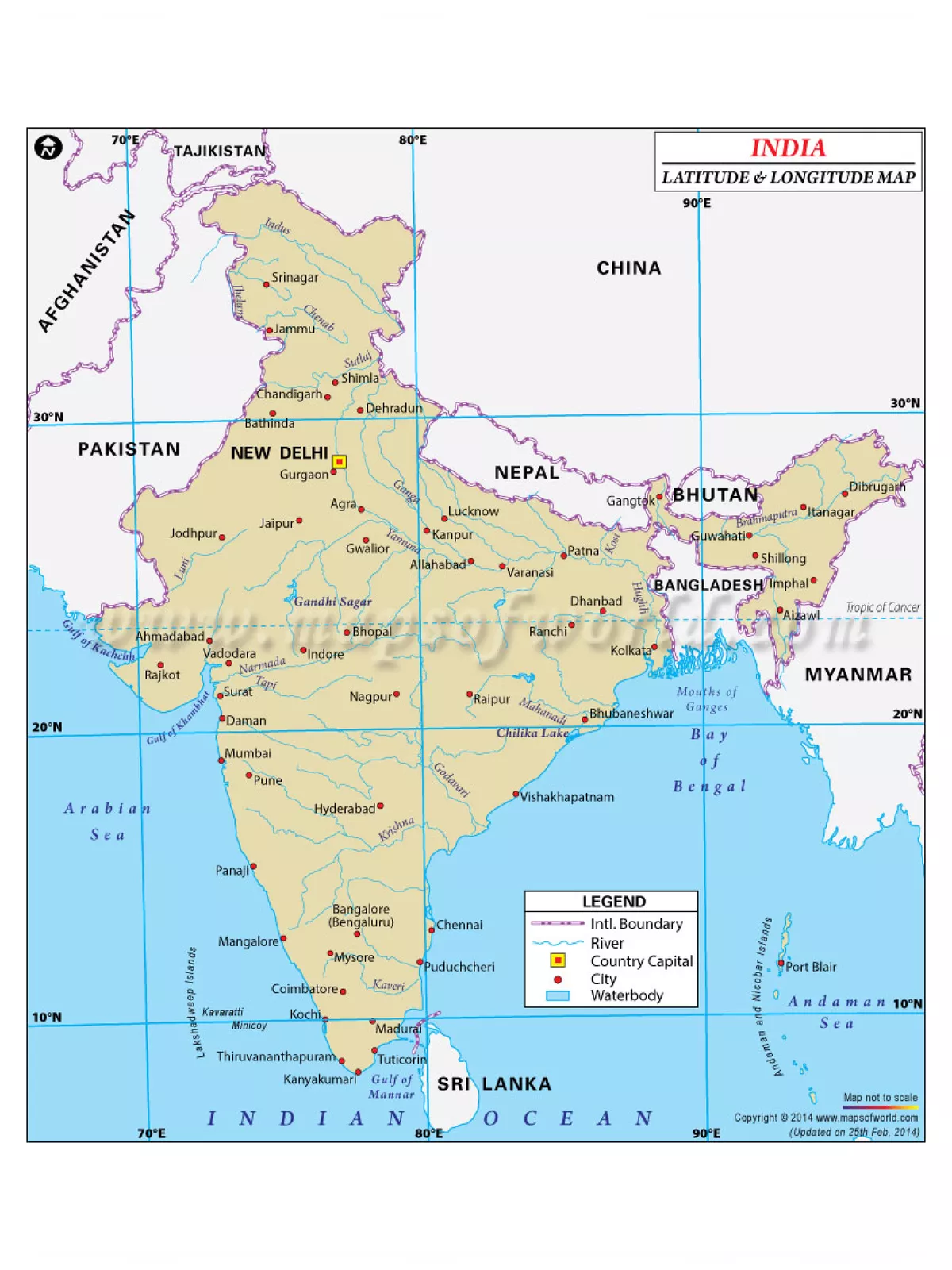
India is the seventh largest country in the world and also ranks second in population. Surrounded by Bangladesh, Burma, Bhutan, China, Nepal, and Pakistan, India covers an area of 3,287,590 sq km. The latitude and longitude of a particular place help you know the exact situation of that place on Earth. The latitude and longitude of India are 20′ North and 77′ East respectively.
India is a vast country. Lying entirely in the Northern hemisphere the mainland extends between latitudes 8°4’N and 37°6’N and longitudes 68°7’E and 97°25’E. Bordered by the Bay of Bengal, Arabian Sea, and the Indian Ocean it also has a coastline of more than 7,000 km. It has 28 states and 8 Union Territories. The most popular metropolitan cities in India are Mumbai, Kolkata, Delhi, Chennai, and Bangalore.
India Map with Latitude and Longitude
- India is divided into 28 States (further subdivided into districts) and 8 union territories including the National capital territory (i.e., Delhi). India’s borders run a total length of 15,200 km (9,400 mi)
- Longitude is a point from the prime meridian, estimated toward the east (longitudes toward the west are negative). Latitudes measure a point up from the equator (latitudes toward the south are negative). Complete answer: India lies between 8∘4′ to 37∘6′ North latitudes and 68∘7′ to 97∘25′ east longitudes.
You can download the India Map with Latitude and Longitude PDF using the link given below.