Metro Map Hyderabad
Hyderabad Metro Rail (HMR) is the world’s largest Public-Private Partnership (PPP) project in the Metro rail sector. Metro rail and other forms of Mass Rapid Transport System (MRTS) are emerging as prominent infrastructure requirements offering a viable solution to the transportation woes that accompany urban expansion.
Hyderabad Metro Rail (HMR) Project is an integrated urban transport development project with inter-modal connectivity and convenient skywalks that will mark the beginning of an era of seamless commuting across Hyderabad.
Metro Map Hyderabad (Hyderabad Metro Rail Map)
Hyderabad Metro Rail (HMR) is a ‘green’ transportation system that will reduce carbon footprint through efficient power consumption, rainwater harvesting and other processes. Every time you ride with us, you contribute to the development of an eco-friendly environment.
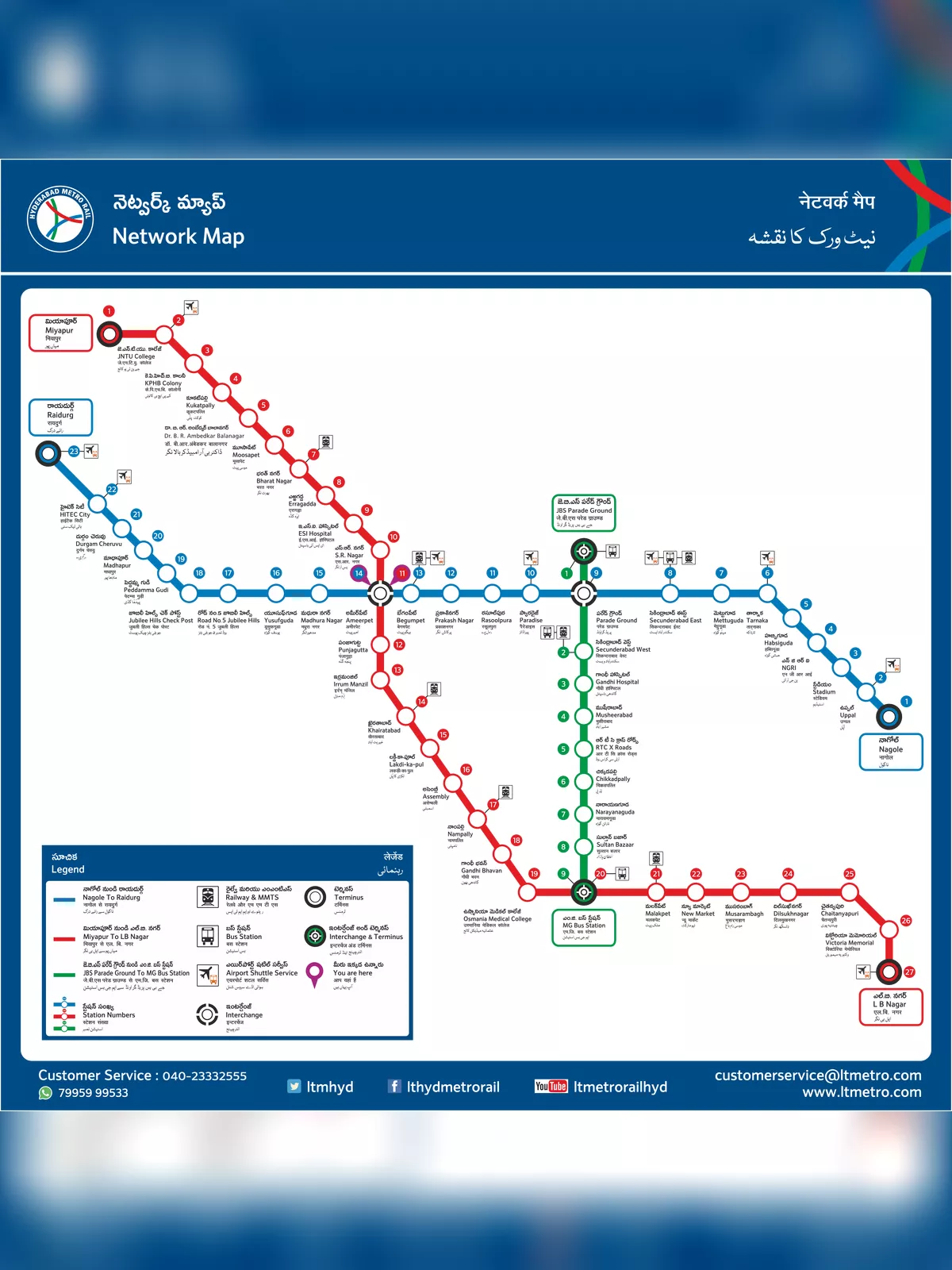
The Hyderabad Metro Rail Network will cover a total distance of around 69.2 Km across three corridors:
- Corridor I: Miyapur to LB Nagar
- Corridor II : JBS to MGBS
- Corridor III : Nagole to Raidurgam
Hyderabad Metro Rail Map download in PDF format.