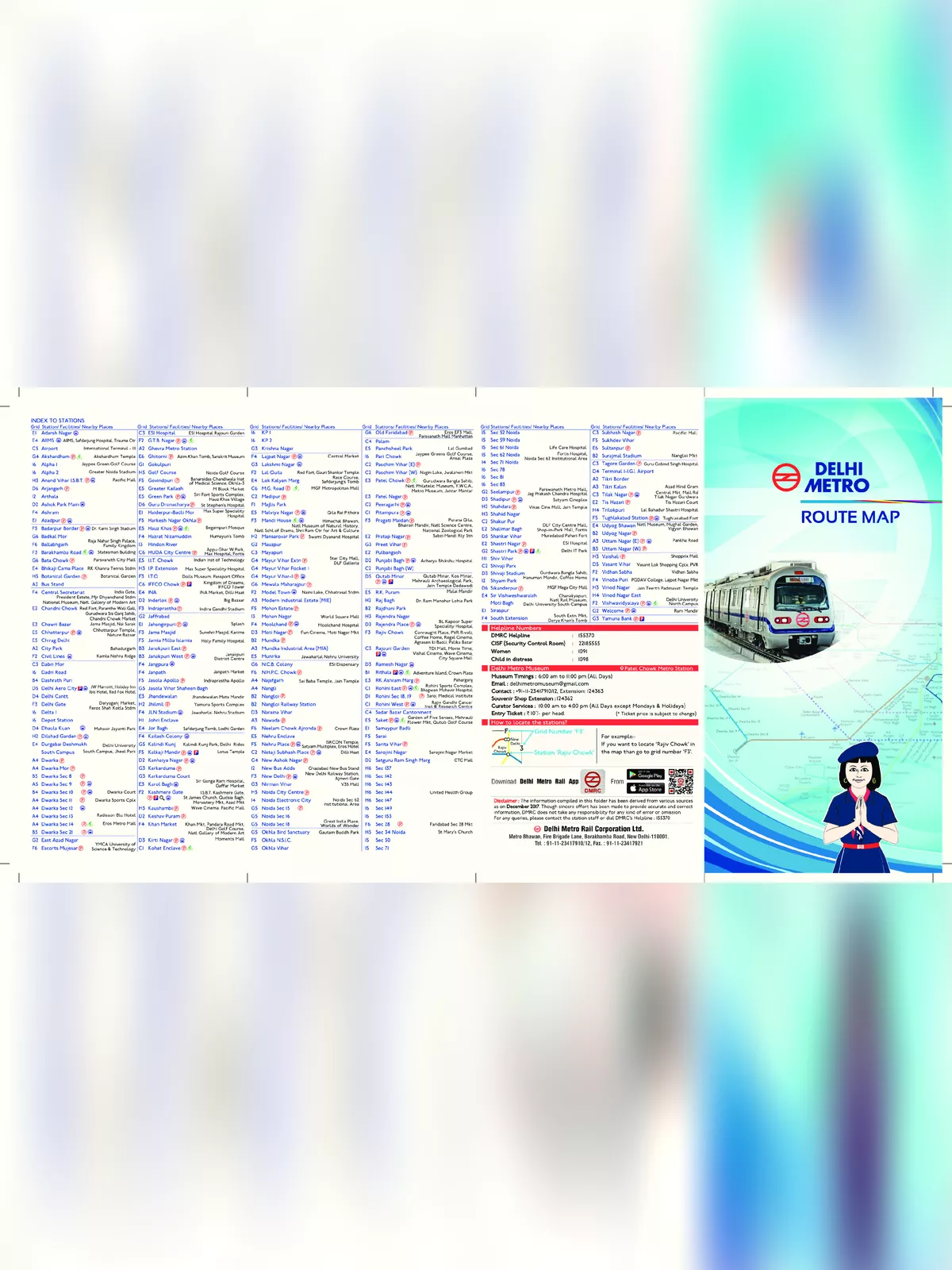
Delhi Metro Route Map
Delhi Metro Map
we share with you Delhi Metro Map PDF & this metro map helps to find the root easily. People who are searching for the Metro Map PDF can easily download it from the link given at the bottom of this page.
Metro Rail network consists of 10 color-coded lines serving 255 stations with a total length of 390.14 kilometers (242 mi), and 286 stations, including the Gurugram Metro and Noida Metro. The Delhi Metro is a rapid transit (MRT) system serving Delhi and its satellite cities of Ghaziabad, Faridabad, Gurugram, Noida, Bahadurgarh, and Ballabhgarh, in the National Capital Region of India. It is by far the largest and busiest metro in India and the second oldest after the Kolkata Metro.
Delhi Metro Map
The system has a mix of underground, at-grade, and elevated stations using both broad-gauge and standard-gauge. Delhi Metro operates over 2,700 trips daily, starting at around 06:00 and ending at 11:00.
Delhi Metro also interchanges with the Rapid Metro Gurugram (with a shared ticketing system) and Noida Metro. On 22 October 2019, the DMRC (Helpline – 155370) took over the operations of the financially troubled Rapid Metro Gurgaon.
Delhi Metro Station Route List
- Noida Electronic City
- Noida Sector 62
- Noida Sector 59
- Noida Sector 61
- Noida Sector 52
- Noida Sector 34
- Noida City Centre
- Noida Golf Course
- Botanical Garden
- Noida Sector 18
- Noida Sector 16
- Noida Sector 15
- New Ashok Nagar
- Mayur Vihar Extension
- Mayur Vihar-I
- Akshardham
- Yamuna Bank
- Indraprastha
- Pragati Maidan
- Mandi House
- Barakhamba Road
- Rajiv Chowk
- R K Ashram Marg
- Jhandewalan
- Karol Bagh
- Rajendra Place
- Patel Nagar
- Shadipur
- Kirti Nagar
- Moti Nagar
- Ramesh Nagar
- Rajouri Garden
- Tagore Garden
- Subhash Nagar
- Janakpuri East
- Janakpuri West
- Uttam Nagar East
- Uttam Nagar West
- Nawada
- Dwarka Mor
- Dwarka
- Dwarka Sector 14
- Dwarka Sector 13
- Dwarka Sector 12
- Dwarka Sector 11
- Dwarka Sector 10
- Dwarka Sector 9
- Dwarka Sector 8
- Dwarka Sector 21
Delhi-NCR Metro Route Map
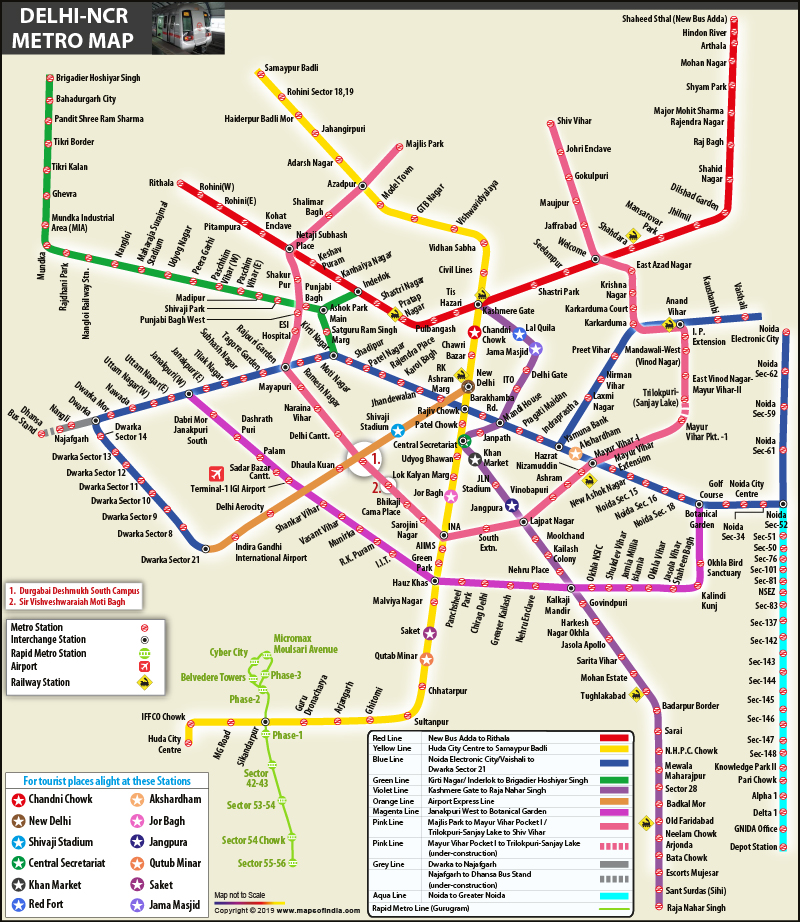
You can download the Delhi Metro Map PDF format using the link given below.